
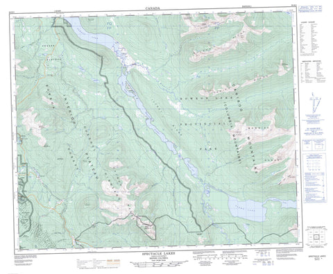
093H03 Spectacle Lakes Canada topo map, 1:50,000 scale
093H03 Spectacle Lakes NRCAN topographic map.
Includes UTM and GPS geographic coordinates (latitude and longitude). This 50k scale map is suitable for hiking, camping, and exploring, or you could frame it as a wall map.
Printed on-demand using high resolution, on heavy weight and acid free paper, or as an upgrade on a variety of synthetic materials.
Topos available on paper, Waterproof, Poly, or Tyvek. Usually shipping rolled, unless combined with other folded maps in one order.
- Product Number: NRCAN-093H03
- Parent Topo: TOPO-093H
- Map ID also known as: 093H03, 93H3, 93H03
- Unfolded Size: Approximately 26" high by 36" wide
- Weight (paper map): ca. 55 grams
- Map Type: POD NRCAN Topographic Map
- Map Scale: 1:50,000
- Geographical region: British Columbia, Canada
Neighboring Maps:
All neighboring Canadian topo maps are available for sale online at 1:50,000 scale.
Purchase the smaller scale map covering this area: Topo-093H
Spatial coverage:
Topo map sheet 093H03 Spectacle Lakes covers the following places:
- Pat Point - Cariboo Falls - Pavich Island - Angels Lake - Atan Lake - Babcock Lake - Bonner Lake - Bowron Lake - Chisel Lake - Hospital Lakes - Huckey Lake - Hunter Lake - Isaac Lake - Lanezi Lake - Rum Lake - Sandy Lake - Selina Lake - Skoi Lake - Spectacle Lakes - Swan Lake - Unna Lake - Weldon Lake - Wendle Lake - Blare Mountain - Cariboo Mountains - Columbia Mountains - Devils Club Mountain - Flat Top Mountain - Ford Peak - Guyet Mountain - Iltzul Ridge - Indianpoint Mountain - Kaza Mountain - McCabe Ridge - McLeod Ridge - Mount Blair - Mount Conklin - Mount Faulkner - Mount Greenberry - Mount Guyet - Mount Howley - Mount Hughes - Mount Lesage - Mount Murray - Mount Patchett - Mount Proserpine - Mount Tinsdale - Mowdish Group - Mowdish Range - Needle Point Mountain - Needle Point Ridge - Palmer Mountains - Palmer Range - Quesnel Highland - Sliding Mountain - Tediko Peaks - Tediko Ridge - Turks Nose Mountain - Waverly Mountain - Cariboo Regional District - Barkerville Historic Park - Barkerville Historic Town - Barkerville Park - Bowron Lake Park - Wendle Park - Fraser Plateau - Interior Plateau - Whisky Flat - Alex Allan Creek - Antler Creek - Babcock Creek - Bowron River - Camden Creek - Canadian Creek - Cariboo River - Cunningham Pass Creek - de Witte Reed Creek - Downie Creek - Empire Creek - First Chance Creek - French Creek - Greenberry Creek - Grouse Creek - Guyet Creek - Harold Creek - Huckey Creek - Isaac River - Jubilee Creek - Little Valley Creek - Loskey Creek - Marks Creek - Maude Creek - McCabe Creek - McKenna Creek - McKinnon Creek - Monkton Creek - Murray Creek - Pleasant Valley Creek - Pomeroy Creek - Russian Creek - Siberia Creek - Sisters Creek - St. Lawrence Creek - Summit Creek - Sus Creek - Tinsdale Creek - Two Sisters Creek - Valley Creek - West Creek - Wolf Creek - Wolfe Creek - Yellowhawk Creek - Bowron Slough - Beggs Gulch - California Gulch - Conklin Gulch - Cunningham Pass - Hobo Gulch - McCallum Gulch - Quartz Gulch - Shy Robin Gulch - Stevens Gulch


