
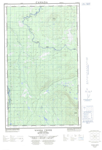
093G16E Wansa Creek Canada topo map, 1:50,000 scale
093G16E Wansa Creek NRCAN topographic map.
Includes UTM and GPS geographic coordinates (latitude and longitude). This 50k scale map is suitable for hiking, camping, and exploring, or you could frame it as a wall map.
Printed on-demand using high resolution, on heavy weight and acid free paper, or as an upgrade on a variety of synthetic materials.
Topos available on paper, Waterproof, Poly, or Tyvek. Usually shipping rolled, unless combined with other folded maps in one order.
- Halfsheet: This map was designed as a half sheet of NRCAN-093G16, and it is the Eastern half. Find the western half sheet here.
- Product Number: NRCAN-093G16E
- Parent Topo: TOPO-093G
- Map ID also known as: 093G16, 93G16
- Unfolded Size: Approximately 26" high by 36" wide
- Weight (paper map): ca. 55 grams
- Map Type: POD NRCAN Topographic Map
- Map Scale: 1:50,000
- Geographical region: British Columbia, Canada
Neighboring Maps:
All neighboring Canadian topo maps are available for sale online at 1:50,000 scale.
Purchase the smaller scale map covering this area: Topo-093G
Spatial coverage:
Topo map sheet 093G16E Wansa Creek covers the following places:
- Cottonwood Island - Francis Lake - Frost Lake - Wansa Lake - Mount Bowron - Mount Tabor - Spring Mountain - Regional District of Fraser-Fort George - Fraser Plateau - Interior Plateau - Bowes Creek - Bowron River - Corless Creek - Dougherty Creek - England Creek - Kerry Creek - La Pier Creek - La Pierre Creek - Spey Creek - Taspai Creek - Tsadestsa Creek - Vama Vama Creek - Wansa Creek - Willow River - Ferndale - Basket Canyon - Bear Canyon - Boat Canyon - Box Canyon - Portage Canyon


