
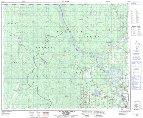
093G02 Cottonwood Canyon Canada topo map, 1:50,000 scale
093G02 Cottonwood Canyon NRCAN topographic map.
Includes UTM and GPS geographic coordinates (latitude and longitude). This 50k scale map is suitable for hiking, camping, and exploring, or you could frame it as a wall map.
Printed on-demand using high resolution, on heavy weight and acid free paper, or as an upgrade on a variety of synthetic materials.
Topos available on paper, Waterproof, Poly, or Tyvek. Usually shipping rolled, unless combined with other folded maps in one order.
- Product Number: NRCAN-093G02
- Parent Topo: TOPO-093G
- Map ID also known as: 093G02, 93G2, 93G02
- Unfolded Size: Approximately 26" high by 36" wide
- Weight (paper map): ca. 55 grams
- Map Type: POD NRCAN Topographic Map
- Map Scale: 1:50,000
- Geographical region: British Columbia, Canada
Neighboring Maps:
All neighboring Canadian topo maps are available for sale online at 1:50,000 scale.
Purchase the smaller scale map covering this area: Topo-093G
Spatial coverage:
Topo map sheet 093G02 Cottonwood Canyon covers the following places:
- Quesnel - Bouchie Lake - Emerald Lake - Herkyelthtie Lake - Lazaroff Lake - Milburn Lake - Mit Lake - Nelson Kenny Lake - Nelsonkenny Lake - Squamish Lake - Blackwater Mountain - Mount Milburn - Cariboo Regional District - Fraser Plateau - Interior Plateau - Bartee Creek - Bluestone Creek - Bouchie Creek - Bourbon Creek - Bourgeois Creek - Buchan Creek - Charleson Creek - Chevans Creek - Cottonwood River - Crimen Creek - Doran Creek - Fraser River - Garvey Creek - Herkyelthtie Creek - Jordan Creek - Little Bartee Creek - Little Trout Creek - Nelson Kenny Creek - Nelsonkenny Creek - Purser Creek - Whittier Creek - Winger Creek - Baker - Bouchie Lake - Moose Heights - Cottonwood Canyon


