
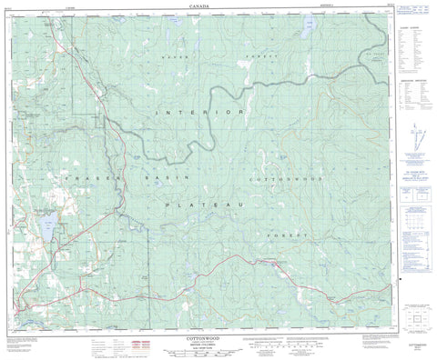
093G01 Cottonwood Canada topo map, 1:50,000 scale
093G01 Cottonwood NRCAN topographic map.
Includes UTM and GPS geographic coordinates (latitude and longitude). This 50k scale map is suitable for hiking, camping, and exploring, or you could frame it as a wall map.
Printed on-demand using high resolution, on heavy weight and acid free paper, or as an upgrade on a variety of synthetic materials.
Topos available on paper, Waterproof, Poly, or Tyvek. Usually shipping rolled, unless combined with other folded maps in one order.
- Product Number: NRCAN-093G01
- Parent Topo: TOPO-093G
- Map ID also known as: 093G01, 93G1, 93G01
- Unfolded Size: Approximately 26" high by 36" wide
- Weight (paper map): ca. 55 grams
- Map Type: POD NRCAN Topographic Map
- Map Scale: 1:50,000
- Geographical region: British Columbia, Canada
Neighboring Maps:
All neighboring Canadian topo maps are available for sale online at 1:50,000 scale.
Purchase the smaller scale map covering this area: Topo-093G
Spatial coverage:
Topo map sheet 093G01 Cottonwood covers the following places:
- Quesnel - Ahbau Lake - Angus Lake - Bellos Lake - Black Lake - Bufton Lake - Coldspring Lake - Davey Lake - Fifteen Mile Lake - Genevieve Lake - Greening Slough - Hush Lake - Hyde Lake - Jess Lake - Kenny Lake - Porcupine Lake - Sixteen Mile Lake - Ten Mile Lake - Thirteen Mile Lake - Yeates Lake - Mouse Mountain - Cariboo Regional District - Cottonwood House Historic Park - Cottonwood House Park - Cottonwood River Park - Moose Heights Park - Ten Mile Lake Park - Interior Plateau - Ahbau Creek - Alder Creek - Alice Creek - Angus Creek - Barlow Creek - Barry Creek - Bellos Creek - Bufton Creek - Burton Creek - Coldspring Creek - Cottonwood River - Frye Creek - Gagen Creek - Genevieve Creek - Hush Creek - John Boyd Creek - Lake Creek - Lightning Creek - Lost Valley Creek - Mary Creek - Meadowbank Creek - Mostique Creek - Moustique Creek - Nelson Kenny Creek - Nelsonkenny Creek - Norn Creek - Norton Creek - Pundata Creek - Quesnel River - Stacey Creek - Swift River - Tertiary Creek - Toklo Creek - Umiti Creek - Ahbau - Barlow - Barlow Creek - Bellos - Cinema - Coldspring House - Cottonwood - Cotwood - Greening - Moose Heights - Ten Mile Lake - Big Canyon - Alder Marsh


