
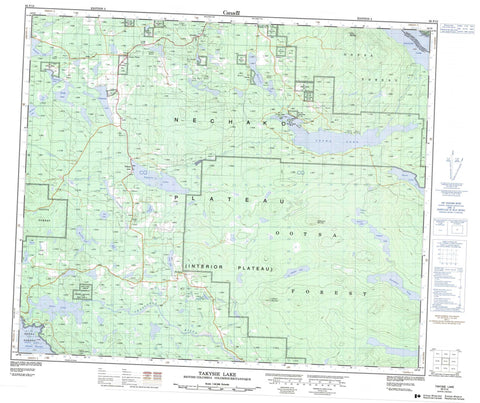
093F13 Takysie Lake Canada topo map, 1:50,000 scale
093F13 Takysie Lake NRCAN topographic map.
Includes UTM and GPS geographic coordinates (latitude and longitude). This 50k scale map is suitable for hiking, camping, and exploring, or you could frame it as a wall map.
Printed on-demand using high resolution, on heavy weight and acid free paper, or as an upgrade on a variety of synthetic materials.
Topos available on paper, Waterproof, Poly, or Tyvek. Usually shipping rolled, unless combined with other folded maps in one order.
- Product Number: NRCAN-093F13
- Parent Topo: TOPO-093F
- Map ID also known as: 093F13, 93F13
- Unfolded Size: Approximately 26" high by 36" wide
- Weight (paper map): ca. 55 grams
- Map Type: POD NRCAN Topographic Map
- Map Scale: 1:50,000
- Geographical region: British Columbia, Canada
Neighboring Maps:
All neighboring Canadian topo maps are available for sale online at 1:50,000 scale.
Purchase the smaller scale map covering this area: Topo-093F
Spatial coverage:
Topo map sheet 093F13 Takysie Lake covers the following places:
- Cheslatta Indian Reserve 1 - Eastern Island Indian Reserve 13 - Omineca Indian Reserve 1 - Réserve indienne Cheslatta 1 - Réserve indienne Eastern Island 13 - Réserve indienne Omineca 1 - Réserve indienne Skin Lake 15 - Réserve indienne Skins Lake 16A - Réserve indienne Skins Lake 16B - Réserve indienne Uncha Lake 13A - Réserve indienne Western Island 14 - Skin Lake Indian Reserve 15 - Skins Lake Indian Reserve 16A - Skins Lake Indian Reserve 16B - Uncha Lake Indian Reserve 13A - Western Island Indian Reserve 14 - Acorn Lake - Beaver Lake - Beaver Lake - Bickle Lake - Binta Lake - Boyd Lake - Castor Lake - Clatlatiently Lake - Eakin Lake - Edlund Lake - Enter Lake - François Lake - Getzuni Lake - Hewson Lake - Innes Lake - Jack Weekes Lake - Llgitiyuz Lake - Long Lake - Lower Innis Lake - Mollice Lake - Moss Lake - Moxley Lake - Murdoch Lake - Nechako Reservoir - Ootsa Lake - Ootsanee Lake - Otto Lake - Ranier Lake - Robertson Lake - Sather Lake - Skins Lake - Small Trout Lake - Snowflake Lake - Spencha Lake - Spud Lake - Star Lake - Takysie Lake - Tatalaska Lake - Tatalrose Lake - Totem Pole Lake - Uncha Lake - Warin Lake - Westman Lake - York Lake - Dayeezcha Mountain - Llgitiyuz Mountain - Skins Dome - Uncha Mountain - Regional District of Bulkley-Nechako - Mollice Lake Park - Uncha Mountain Red Hills Park - Interior Plateau - Nechako Plateau - Cheslatta River - Clatlatiently Creek - Dog Creek - East Moxley Creek - East Side Creek - Hawley Creek - Jack Weekes Creek - Moxley Creek - Small Trout Creek - Spencha Creek - Takysie Creek - Tatalaska Creek - Tatalrose Creek - Totem Pole Creek - Uncha Creek - Bickle - Cheslatta - Danskin - Grassy Plains - Takysie Lake - Tatalrose


