
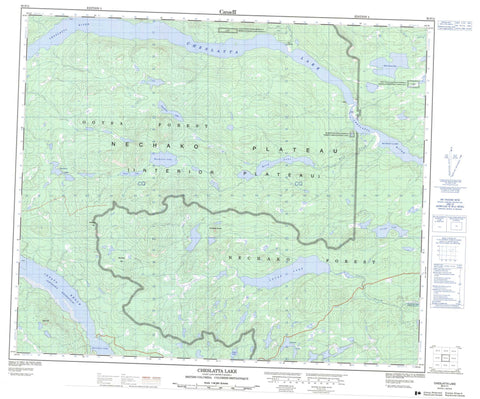
093F11 Cheslatta Lake Canada topo map, 1:50,000 scale
093F11 Cheslatta Lake NRCAN topographic map.
Includes UTM and GPS geographic coordinates (latitude and longitude). This 50k scale map is suitable for hiking, camping, and exploring, or you could frame it as a wall map.
Printed on-demand using high resolution, on heavy weight and acid free paper, or as an upgrade on a variety of synthetic materials.
Topos available on paper, Waterproof, Poly, or Tyvek. Usually shipping rolled, unless combined with other folded maps in one order.
- Product Number: NRCAN-093F11
- Parent Topo: TOPO-093F
- Map ID also known as: 093F11, 93F11
- Unfolded Size: Approximately 26" high by 36" wide
- Weight (paper map): ca. 55 grams
- Map Type: POD NRCAN Topographic Map
- Map Scale: 1:50,000
- Geographical region: British Columbia, Canada
Neighboring Maps:
All neighboring Canadian topo maps are available for sale online at 1:50,000 scale.
Purchase the smaller scale map covering this area: Topo-093F
Spatial coverage:
Topo map sheet 093F11 Cheslatta Lake covers the following places:
- Alexis Thomas Indian Reserve 1A - Holy Cross Lake Indian Reserve 3 - Murray Lake Indian Reserve 4 - Réserve indienne Alexis Thomas 1A - Réserve indienne Holy Cross Lake 3 - Réserve indienne Murray Lake 4 - Bird Lake - Chaoborus Lake - Cheslatta Lake - Cicuta Lake - Davidson Lake - Emmett Lake - Holy Cross Lake - Hoult Lake - Intata Lake - Knewstubb Lake - Lucas Lake - Mackenzie Lake - Murray Lake - Natalkuz Lake - Nechako Reservoir - Smith Lake - Deerhorn Hill - Saunders Hill - Table Hill - The Devils Thumb - Regional District of Bulkley-Nechako - Interior Plateau - Nechako Plateau - Bird Creek - Cheslatta River - Knapp Creek - Lucas Creek - Ootsa River - Targe Creek - Intata Reach


