
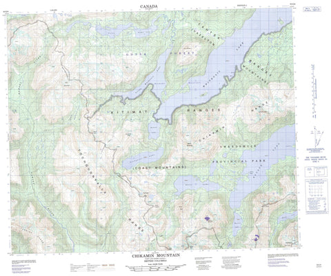
093E06 Chikamin Mountain Canada topo map, 1:50,000 scale
093E06 Chikamin Mountain NRCAN topographic map.
Includes UTM and GPS geographic coordinates (latitude and longitude). This 50k scale map is suitable for hiking, camping, and exploring, or you could frame it as a wall map.
Printed on-demand using high resolution, on heavy weight and acid free paper, or as an upgrade on a variety of synthetic materials.
Topos available on paper, Waterproof, Poly, or Tyvek. Usually shipping rolled, unless combined with other folded maps in one order.
- Product Number: NRCAN-093E06
- Parent Topo: TOPO-093E
- Map ID also known as: 093E06, 93E6, 93E06
- Unfolded Size: Approximately 26" high by 36" wide
- Weight (paper map): ca. 55 grams
- Map Type: POD NRCAN Topographic Map
- Map Scale: 1:50,000
- Geographical region: British Columbia, Canada
Neighboring Maps:
All neighboring Canadian topo maps are available for sale online at 1:50,000 scale.
Purchase the smaller scale map covering this area: Topo-093E
Spatial coverage:
Topo map sheet 093E06 Chikamin Mountain covers the following places:
- Zinc Bay - Trapp Point - Arete Island - Maroon Island - Coles Lake - Cosgrove Lake - Eutsuk Lake - Haven Lake - Kenney Lake - Lindquist Lake - Little Whitesail Lake - Musclow Lake - Nechako Reservoir - Seel Lake - Surel Lake - Whitesail Lake - Arete Mountain - Arête Mountain - Chaîne Côtière - Chikamin Mountain - Chikamin Range - Coast Mountains - Core Mountain - Kitimat Ranges - Lindquist Peak - Mount Haven - Mount Irma - Mount Musclow - Mount Stranack - Musclow Mountain - Price Peak - Ptarmigan Peak - Sias Mountain - Smaby Peak - Surel Peak - Tenaiko Mountains - Tenaiko Range - Tochquonyalla Mountains - Tochquonyalla Range - Central Coast Regional District - Regional District of Bulkley-Nechako - Regional District of Kitimat-Stikine - Tweedsmuir Park - Tweedsmuir Recreation Area - Chatsquot Creek - Chikamin Creek - Coles Creek - Ear Creek - Gamsby Creek - Gamsby River - George Creek - McCuish Creek - Salahagen Creek - Sias Creek - Troitsa Creek - Gardé Pass - Lindquist Pass - McCuish Pass - Surel Pass


