
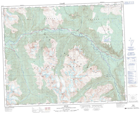
093D08 Stuie Canada topo map, 1:50,000 scale
093D08 Stuie NRCAN topographic map.
Includes UTM and GPS geographic coordinates (latitude and longitude). This 50k scale map is suitable for hiking, camping, and exploring, or you could frame it as a wall map.
Printed on-demand using high resolution, on heavy weight and acid free paper, or as an upgrade on a variety of synthetic materials.
Topos available on paper, Waterproof, Poly, or Tyvek. Usually shipping rolled, unless combined with other folded maps in one order.
- Product Number: NRCAN-093D08
- Parent Topo: TOPO-093D
- Map ID also known as: 093D08, 93D8, 93D08
- Unfolded Size: Approximately 26" high by 36" wide
- Weight (paper map): ca. 55 grams
- Map Type: POD NRCAN Topographic Map
- Map Scale: 1:50,000
- Geographical region: British Columbia, Canada
Neighboring Maps:
All neighboring Canadian topo maps are available for sale online at 1:50,000 scale.
Purchase the smaller scale map covering this area: Topo-093D
Spatial coverage:
Topo map sheet 093D08 Stuie covers the following places:
- Range 3 Coast Land District - East Saugstad Glacier - Mad Dog Glacier - Nooklikonnik Glacier - Hump Lake - Long Lake - Bastille Mountain - Chaîne Côtière - Coast Mountains - Defiance Mountain - Happy Meadow Dome - Kitimat Ranges - Mad Dog Mountain - Matterhorn Peak - Melikan Mountain - Monster Peak - Mount Arjuna - Mount Corbould - Mount Nyland - Mount Walker - Nusatsum Mountain - Orbit Spire - Pacific Ranges - Salloomt Peak - Space Point Peak - Stupendous Mountain - Table Mountain - The Horn - Central Coast Regional District - Fraser Plateau - Interior Plateau - Assanany Creek - Assanany River - Atnarko River - Bear Camp Creek - Bella Coola River - Burnt Bridge Creek - Cacoohtin Creek - Corbould Creek - Horsetail Creek - Kahylskt Creek - Kahylskt River - Molly Creek - Noomst Creek - Noomst River - Noosgulch River - Nootsatsum River - Nordschow Creek - Nusatsum River - Stener Creek - Talchako River - Tseapseahoolz Creek - Tseapseahoolz River - Tsill Creek - Tsini Tsini Creek - Firvale - Stuie - Deception Pass - Mosquito Pass


