
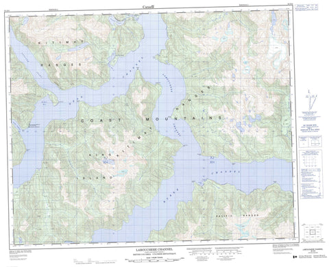
093D06 Labouchere Channel Canada topo map, 1:50,000 scale
093D06 Labouchere Channel NRCAN topographic map.
Includes UTM and GPS geographic coordinates (latitude and longitude). This 50k scale map is suitable for hiking, camping, and exploring, or you could frame it as a wall map.
Printed on-demand using high resolution, on heavy weight and acid free paper, or as an upgrade on a variety of synthetic materials.
Topos available on paper, Waterproof, Poly, or Tyvek. Usually shipping rolled, unless combined with other folded maps in one order.
- Product Number: NRCAN-093D06
- Parent Topo: TOPO-093D
- Map ID also known as: 093D06, 93D6, 93D06
- Unfolded Size: Approximately 26" high by 36" wide
- Weight (paper map): ca. 55 grams
- Map Type: POD NRCAN Topographic Map
- Map Scale: 1:50,000
- Geographical region: British Columbia, Canada
Neighboring Maps:
All neighboring Canadian topo maps are available for sale online at 1:50,000 scale.
Purchase the smaller scale map covering this area: Topo-093D
Spatial coverage:
Topo map sheet 093D06 Labouchere Channel covers the following places:
- Cascade Inlet - Croyden Bay - Elcho Harbour - Eucott Bay - Jacobsen Bay - McKay Bay - Nascall Bay - Cape McKay - Deas Point - Edward Point - Elcho Point - Fougner Point - Hokonson Point - Kwaspala Point - Labouchere Point - Lalakata Point - Menzies Point - Mesachie Nose - Ovesen Point - Burke Channel - Dean Channel - Labouchere Channel - Cascade Bluff - Ram Bluff - King Island - Nascall Lake - Woran Lake - Chaîne Côtière - Coast Mountains - Kitimat Ranges - Pacific Ranges - Central Coast Regional District - Sir Alexander Mackenzie Park - Farquhar River - Nascall River - Nooseseck River - Thorwald Creek - Woran Creek - Eucott Bay Hot Springs - Eucott Hotsprings - Nascall Hot Springs - Nascall Hotsprings


