
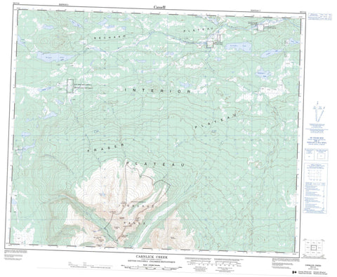
093C14 Carnlick Creek Canada topo map, 1:50,000 scale
093C14 Carnlick Creek NRCAN topographic map.
Includes UTM and GPS geographic coordinates (latitude and longitude). This 50k scale map is suitable for hiking, camping, and exploring, or you could frame it as a wall map.
Printed on-demand using high resolution, on heavy weight and acid free paper, or as an upgrade on a variety of synthetic materials.
Topos available on paper, Waterproof, Poly, or Tyvek. Usually shipping rolled, unless combined with other folded maps in one order.
- Product Number: NRCAN-093C14
- Parent Topo: TOPO-093C
- Map ID also known as: 093C14, 93C14
- Unfolded Size: Approximately 26" high by 36" wide
- Weight (paper map): ca. 55 grams
- Map Type: POD NRCAN Topographic Map
- Map Scale: 1:50,000
- Geographical region: British Columbia, Canada
Neighboring Maps:
All neighboring Canadian topo maps are available for sale online at 1:50,000 scale.
Purchase the smaller scale map covering this area: Topo-093C
Spatial coverage:
Topo map sheet 093C14 Carnlick Creek covers the following places:
- Betty Creek Indian Reserve 18 - Cluchuta Lake Indian Reserve 10A - Cluchuta Lake Indian Reserve 10B - Réserve indienne Betty Creek 18 - Réserve indienne Cluchuta Lake 10A - Réserve indienne Cluchuta Lake 10B - Réserve indienne Salmon River Meadow 7 - Réserve indienne Tzetzi Lake 11 - Salmon River Meadow Indian Reserve 7 - Tzetzi Lake Indian Reserve 11 - Basalt Lake - Cluchuta Lake - Eliguk Lake - Naglico Lake - Pettry Lake - Rainbow Lake - Sedum Lake - Stuyvesant Lake - Tilgatgo Lake - Tsetzi Lake - Tsilbekuz Lake - Tundra Lake - Campanula Peak - Cindercone Peak - Crepis Peak - Crumble Mountain - Dodds Domes - Far Mountain - Hierochloë Peak - Ilgachuz Mountain - Ilgachuz Mountains - Ilgachuz Range - Itcha Range - Mizzen Mountain - Monocephala Peak - Mount Mizzen - Nana Peak - Pipe Organ Mountain - Stonecrop Ridge - Tundra Mountain - Cariboo Regional District - Fraser Plateau - Interior Plateau - Nechako Plateau - Blue Canyon Creek - Carnlick Creek - Far Creek - Festuca Creek - Pan Creek - Phacelia Creek - Rich Creek - Sedum Creek - Shag Creek - Tanswanket Creek - Tsetzi Creek - Ulgako Creek - West Road (Blackwater) River - Festuca Pass


