
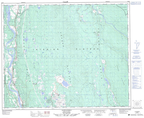
093B09 Alexandria Canada topo map, 1:50,000 scale
093B09 Alexandria NRCAN topographic map.
Includes UTM and GPS geographic coordinates (latitude and longitude). This 50k scale map is suitable for hiking, camping, and exploring, or you could frame it as a wall map.
Printed on-demand using high resolution, on heavy weight and acid free paper, or as an upgrade on a variety of synthetic materials.
Topos available on paper, Waterproof, Poly, or Tyvek. Usually shipping rolled, unless combined with other folded maps in one order.
- Product Number: NRCAN-093B09
- Parent Topo: TOPO-093B
- Map ID also known as: 093B09, 93B9, 93B09
- Unfolded Size: Approximately 26" high by 36" wide
- Weight (paper map): ca. 55 grams
- Map Type: POD NRCAN Topographic Map
- Map Scale: 1:50,000
- Geographical region: British Columbia, Canada
Neighboring Maps:
All neighboring Canadian topo maps are available for sale online at 1:50,000 scale.
Purchase the smaller scale map covering this area: Topo-093B
Spatial coverage:
Topo map sheet 093B09 Alexandria covers the following places:
- Alexandria 1A - Alexandria Indian Reserve 1 - Alexandria Indian Reserve 12 - Alexandria Indian Reserve 1A - Alexandria Indian Reserve 3 - Alexandria Indian Reserve 3A - Hay Ranch Indian Reserve 2 - McKay Meadow Indian Reserve 4 - Réserve indienne Alexandria 1 - Réserve indienne Alexandria 12 - Réserve indienne Alexandria 1A - Réserve indienne Alexandria 3 - Réserve indienne Alexandria 3A - Réserve indienne Hay Ranch 2 - Réserve indienne McKay Meadow 4 - Diamond Island - Alix Lakes - Ben Lake - Blue Lake - Claude Lake - Cuisson Lake - Eveline Lake - Hill Lake - Moffat Lake - Philemon Lake - Skelton Lake - Souran Lake - Valerie Lake - Granite Mountain - Cariboo Regional District - Fraser Plateau - Interior Plateau - Alix Creek - Arbuthnot Creek - Arthur Creek - Australian Creek - Beaver Creek - Beedy Creek - Beernaert Creek - Big Camp Creek - Bowden Creek - Burgess Creek - Credge Creek - Cuisson Creek - Fraser River - Fredy Creek - General Creek - Hodson Creek - Honeyburn Creek - Jerky Creek - Lewis Creek - Lewis Lake - Quesnel River - Sing Lee Creek - Slater Creek - Tingley Creek - Towler Creek - Windt Creek - Castle Rock - Alexandria - Australian - Australian Wye - Castle Rock - Marguerite - Moffat


