
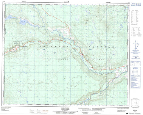
093B04 Redstone Canada topo map, 1:50,000 scale
093B04 Redstone NRCAN topographic map.
Includes UTM and GPS geographic coordinates (latitude and longitude). This 50k scale map is suitable for hiking, camping, and exploring, or you could frame it as a wall map.
Printed on-demand using high resolution, on heavy weight and acid free paper, or as an upgrade on a variety of synthetic materials.
Topos available on paper, Waterproof, Poly, or Tyvek. Usually shipping rolled, unless combined with other folded maps in one order.
- Product Number: NRCAN-093B04
- Parent Topo: TOPO-093B
- Map ID also known as: 093B04, 93B4, 93B04
- Unfolded Size: Approximately 26" high by 36" wide
- Weight (paper map): ca. 55 grams
- Map Type: POD NRCAN Topographic Map
- Map Scale: 1:50,000
- Geographical region: British Columbia, Canada
Neighboring Maps:
All neighboring Canadian topo maps are available for sale online at 1:50,000 scale.
Purchase the smaller scale map covering this area: Topo-093B
Spatial coverage:
Topo map sheet 093B04 Redstone covers the following places:
- Michel Gardens 36 - Redstone Cemetery Indian Reserve 1B - Redstone Flat Indian Reserve 1 - Redstone Flat Indian Reserve 1A - Réserve indienne Redstone Cemetery 1B - Réserve indienne Redstone Flat 1 - Réserve indienne Redstone Flat 1A - Punti Lake - Puntzi Lake - Sisters Hills - Cariboo Regional District - Fraser Plateau - Interior Plateau - Gap Rapids - Alexis Creek - Chilanko River - Chilcotin River - Chilko River - Puntzi Creek - Taseko River - Redstone


