
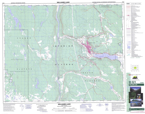
093B01 Williams Lake Canada topo map, 1:50,000 scale
093B01 Williams Lake NRCAN topographic map.
Includes UTM and GPS geographic coordinates (latitude and longitude). This 50k scale map is suitable for hiking, camping, and exploring, or you could frame it as a wall map.
Printed on-demand using high resolution, on heavy weight and acid free paper, or as an upgrade on a variety of synthetic materials.
Topos available on paper, Waterproof, Poly, or Tyvek. Usually shipping rolled, unless combined with other folded maps in one order.
- Product Number: NRCAN-093B01
- Parent Topo: TOPO-093B
- Map ID also known as: 093B01, 93B1, 93B01
- Unfolded Size: Approximately 26" high by 36" wide
- Weight (paper map): ca. 55 grams
- Map Type: POD NRCAN Topographic Map
- Map Scale: 1:50,000
- Geographical region: British Columbia, Canada
Neighboring Maps:
All neighboring Canadian topo maps are available for sale online at 1:50,000 scale.
Purchase the smaller scale map covering this area: Topo-093B
Spatial coverage:
Topo map sheet 093B01 Williams Lake covers the following places:
- Williams Lake - Asahal Lake Indian Reserve 2 - Chimney Creek Indian Reserve 5 - Deep Creek Indian Reserve 2 - Réserve indienne Asahal Lake 2 - Réserve indienne Chimney Creek 5 - Réserve indienne Deep Creek 2 - Réserve indienne San Jose 6 - Réserve indienne Tillion 4 - Réserve indienne Williams Lake 1 - San Jose Indian Reserve 6 - Tillion Indian Reserve 4 - Williams Lake Indian Reserve 1 - Asahal Lake - Barkley Lake - Barnes Lake - Bond Lake - Brunson Lake - Buckskin Lake - Clear Lake - Colpitt Lake - Dead Lake - Dester Lake - Doctors Lake - Fox Lake - Goose Lake - Knox Lake - Lake Blake - Lake Hall - Lake Lye - Leeches Lake - Long Lake - Lost Lake - Minton Lake - Natsy Lake - Reservoir Lake - Richards Lake - Sapper Lake - Till Lake - Twin Lake - Westwick Lake - Westwick Lakes - White Lake - Williams Lake - Champ de manoeuvre Chilcotin - Chilcotin Training Area - Buxton Hill - Fox Mountain - Cariboo Regional District - Fraser Plateau - Interior Plateau - Asahal Creek - Buckskin Creek - Chimney Creek - Comer Creek - Cureven Creek - Fraser River - Frost Creek - Johnny Creek - Meldrum Creek - Mikkelsen Creek - Minton Creek - Missioner Creek - North Fork Whiskey Creek - Pablo Creek - Richards Creek - San Jose River - South Hawks Creek - Sword Creek - Weetman Creek - West Minton Creek - Whiskey Creek - Williams Lake River - Comer - Commodore Heights - Dog Creek - Esler - Glendale - Meldrum - Meldrum Creek - Norlake - Pine Valley - South Lakeside - South Williams Lake - South Yard - Fraser Basin - Stack Valley


