
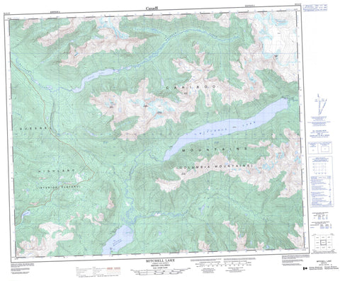
093A15 Mitchell Lake Canada topo map, 1:50,000 scale
093A15 Mitchell Lake NRCAN topographic map.
Includes UTM and GPS geographic coordinates (latitude and longitude). This 50k scale map is suitable for hiking, camping, and exploring, or you could frame it as a wall map.
Printed on-demand using high resolution, on heavy weight and acid free paper, or as an upgrade on a variety of synthetic materials.
Topos available on paper, Waterproof, Poly, or Tyvek. Usually shipping rolled, unless combined with other folded maps in one order.
- Product Number: NRCAN-093A15
- Parent Topo: TOPO-093A
- Map ID also known as: 093A15, 93A15
- Unfolded Size: Approximately 26" high by 36" wide
- Weight (paper map): ca. 55 grams
- Map Type: POD NRCAN Topographic Map
- Map Scale: 1:50,000
- Geographical region: British Columbia, Canada
Neighboring Maps:
All neighboring Canadian topo maps are available for sale online at 1:50,000 scale.
Purchase the smaller scale map covering this area: Topo-093A
Spatial coverage:
Topo map sheet 093A15 Mitchell Lake covers the following places:
- North Arm - Goose Point - Ghost Lake - Hilda Lake - Maeford Lake - Mitchell Lake - Quesnel Lake - Cariboo Mountain - Columbia Mountains - Miller Peaks - Mitchell Mountain - Mount Matthew - Mount Mitchell - Mount Spranger - Mount Youngren - Quesnel Highland - Roberts Peak - Cariboo Regional District - Cariboo Mountains Park - Mitchell Lake/Niagara Park - Interior Plateau - Cameron Creek - Connection Creek - Kimball Creek - Little River - Matthew River - Mitchell River - Penfold Creek - Service Creek


