
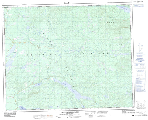
093A03 Eagle Murphy Lake Canada topo map, 1:50,000 scale
093A03 Eagle Murphy Lake NRCAN topographic map.
Includes UTM and GPS geographic coordinates (latitude and longitude). This 50k scale map is suitable for hiking, camping, and exploring, or you could frame it as a wall map.
Printed on-demand using high resolution, on heavy weight and acid free paper, or as an upgrade on a variety of synthetic materials.
Topos available on paper, Waterproof, Poly, or Tyvek. Usually shipping rolled, unless combined with other folded maps in one order.
- Product Number: NRCAN-093A03
- Parent Topo: TOPO-093A
- Map ID also known as: 093A03, 93A3, 93A03
- Unfolded Size: Approximately 26" high by 36" wide
- Weight (paper map): ca. 55 grams
- Map Type: POD NRCAN Topographic Map
- Map Scale: 1:50,000
- Geographical region: British Columbia, Canada
Neighboring Maps:
All neighboring Canadian topo maps are available for sale online at 1:50,000 scale.
Purchase the smaller scale map covering this area: Topo-093A
Spatial coverage:
Topo map sheet 093A03 Eagle Murphy Lake covers the following places:
- Coyote Point - Millie Point - Coffee Lake - Cossack Lake - Eagle (Murphy) Lake - McIntosh Lakes - Moffat Lakes - Murphy (Eagle) Lake - Murphy Lake - Oie Lake - Spout Lake - Tillicum Lake - Tisdall Lake - Two Mile Lake - Walters Lake - Quesnel Highland - Cariboo Regional District - Fraser Plateau - Interior Plateau - Blue Moon Creek - Borthwick Creek - Buster Creek - Coyote Point Creek - Deerhorn Creek - Dry Creek - Eagle Creek - First Creek - Harrison Creek - Moffat Creek - Murphy Creek - Mussel Creek - Oie Creek - Thearon Creek - Tisdall Creek - Two Mile Creek - Woodjam Creek


