
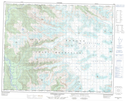
092N02 Homathko Icefield Canada topo map, 1:50,000 scale
092N02 Homathko Icefield NRCAN topographic map.
Includes UTM and GPS geographic coordinates (latitude and longitude). This 50k scale map is suitable for hiking, camping, and exploring, or you could frame it as a wall map.
Printed on-demand using high resolution, on heavy weight and acid free paper, or as an upgrade on a variety of synthetic materials.
Topos available on paper, Waterproof, Poly, or Tyvek. Usually shipping rolled, unless combined with other folded maps in one order.
- Product Number: NRCAN-092N02
- Parent Topo: TOPO-092N
- Map ID also known as: 092N02, 92N2, 92N02
- Unfolded Size: Approximately 26" high by 36" wide
- Weight (paper map): ca. 55 grams
- Map Type: POD NRCAN Topographic Map
- Map Scale: 1:50,000
- Geographical region: British Columbia, Canada
Neighboring Maps:
All neighboring Canadian topo maps are available for sale online at 1:50,000 scale.
Purchase the smaller scale map covering this area: Topo-092N
Spatial coverage:
Topo map sheet 092N02 Homathko Icefield covers the following places:
- Cambridge Glacier - Gallery Glacier - Gargoyle Glacier - Heakamie Glacier - Homathko Icefield - Homathko Snowfield - Jewakwa Glacier - Klattasine Glacier - Queen Bess Glacier - West Grenville Glacier - Burghley Peak - Cambridge Peak - Chaîne Côtière - Chisel Peak - Coast Mountains - Diadem Peak - Gallery Peak - Gargoyle Peak - Heakamie Mountain - Howard Peak - Janus Peak - Jewakwa Mountain - Klattasine Ridge - Landmark Mountain - Marble Rib Mountain - Mist Peak - Mount Heakamie - Mount Jewakwa - Mount Klattasine - Mount Teaquahan - Nunatak Peak - Pacific Ranges - Pelorus Peak - Plateau Peak - Sundial Peak - Teaquahan Mountain - Whitemantle Range - Regional District of Comox-Strathcona - Coola Creek - Doran Creek - Heakamie River - Homathko River - Jewakwa River - Klattasine Creek - Smith Creek - Teaquahan Creek - Teaquahan River - Sasquatch Pass - Waddington Canyon


