
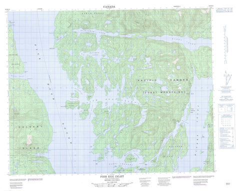
092M12 Fish Egg Inlet Canada topo map, 1:50,000 scale
092M12 Fish Egg Inlet NRCAN topographic map.
Includes UTM and GPS geographic coordinates (latitude and longitude). This 50k scale map is suitable for hiking, camping, and exploring, or you could frame it as a wall map.
Printed on-demand using high resolution, on heavy weight and acid free paper, or as an upgrade on a variety of synthetic materials.
Topos available on paper, Waterproof, Poly, or Tyvek. Usually shipping rolled, unless combined with other folded maps in one order.
- Product Number: NRCAN-092M12
- Parent Topo: TOPO-092M
- Map ID also known as: 092M12, 92M12
- Unfolded Size: Approximately 26" high by 36" wide
- Weight (paper map): ca. 55 grams
- Map Type: POD NRCAN Topographic Map
- Map Scale: 1:50,000
- Geographical region: British Columbia, Canada
Neighboring Maps:
All neighboring Canadian topo maps are available for sale online at 1:50,000 scale.
Purchase the smaller scale map covering this area: Topo-092M
Spatial coverage:
Topo map sheet 092M12 Fish Egg Inlet covers the following places:
- Charcoal Bay - False Inlet - Fifer Bay - Finn Bay - Fish Egg Inlet - Fish Trap Bay - Frypan Bay - Geetla Inlet - Gildersleeve Bay - Goldstream Harbour - Green Island Anchorage - Hardy Inlet - Hemasila Inlet - Henderson Bay - Illahie Arm - Illahie Inlet - Joe's Bay - Johnston Bay - Kwakume Inlet - Mantrap Inlet - McClusky Bay - Morgan Bay - Oyster Bay - Philip Inlet - Pierce Bay - Rivers Inlet - Safety Cove - Sandell Bay - Sleepy Bay - Sulphur Arm - Taylor Bay - Wannock Cove - Waterfall Inlet - Addenbroke Point - Arthur Point - Bosquet Point - Call Point - Christopher Point - Experiment Point - Fleming Point - Guise Point - Hanbury Point - Kelp Point - Kelpie Point - Kwakume Point - Long Point - McLeod Point - North Point - Safety Point - South Point - Stone Point - Truman Point - Umme Point - Wedgborough Point - Whidbey Point - Bickle Passage - Convoy Passage - Darby Channel - Fairmile Passage - Fitz Hugh Sound - Klaquaek Channel - Kwakshua Channel - Patrol Passage - Souvenir Passage - The Narrows - Weeolk Passage - Cockmi Indian Reserve 3 - Réserve indienne Cockmi 3 - Addenbroke Island - Bald Islet - Blair Island - Calvert Island - Corvette Islands - Edna Mathews Island - Ethel Island - Florence Island - Green Island - Hat Island - Hecate Island - Ida Island - Lone Island - Mary Island - Morrow Island - Pendleton Island - Penrose Island - Salvage Island - Sweeper Island - The Haystack - Walbran Island - Welch Island - Agnes Lake - Ash Lake - Cookson Lake - Doris Lake - Elizabeth Lagoon - Elizabeth Lake - Elsie Lake - Hoy Lake - Mullion Lake - Cape Range - Chaîne Côtière - Coast Mountains - Koeye Range - Mount Buxton - Pacific Ranges - Safety Mountain - Central Coast Regional District - Hakai Recreation Area - Penrose Island Marine Park - The Rapids - Doris Creek - MacNair Creek - Matilda Creek - Newichy Creek - Oatsoalis Creek - Rutherford Creek - Sandell River - Third Creek - Tseeiskay River - Barge Rock - Barracuda Rock - Clip Rock - Evening Rock - Nucleus Reef - Stevens Rocks - Storm Rock - Swan Rock - Beaver - Brunswick - Dawson Landing - Dawsons Landing - Good Hope - Provincial Cannery - Wadhams


