
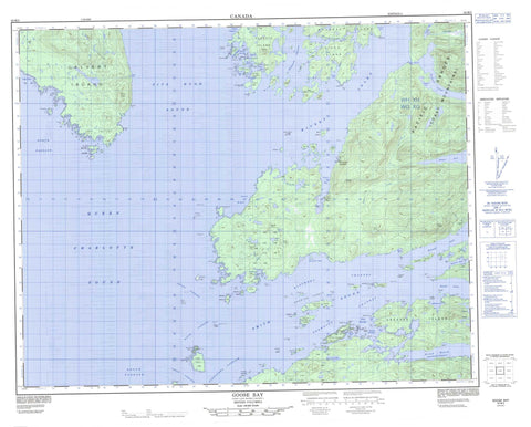
092M05 Goose Bay Canada topo map, 1:50,000 scale
092M05 Goose Bay NRCAN topographic map.
Includes UTM and GPS geographic coordinates (latitude and longitude). This 50k scale map is suitable for hiking, camping, and exploring, or you could frame it as a wall map.
Printed on-demand using high resolution, on heavy weight and acid free paper, or as an upgrade on a variety of synthetic materials.
Topos available on paper, Waterproof, Poly, or Tyvek. Usually shipping rolled, unless combined with other folded maps in one order.
- Product Number: NRCAN-092M05
- Parent Topo: TOPO-092M
- Map ID also known as: 092M05, 92M5, 92M05
- Unfolded Size: Approximately 26" high by 36" wide
- Weight (paper map): ca. 55 grams
- Map Type: POD NRCAN Topographic Map
- Map Scale: 1:50,000
- Geographical region: British Columbia, Canada
Neighboring Maps:
All neighboring Canadian topo maps are available for sale online at 1:50,000 scale.
Purchase the smaller scale map covering this area: Topo-092M
Spatial coverage:
Topo map sheet 092M05 Goose Bay covers the following places:
- Anchor Bight - Angle Bay - Big Frypan Bay - Bleak Bay - Boswell Inlet - Broad Bay - Bull Cove - Canoe Cove - Chic Chic Bay - Draney Inlet - Dsulish Bay - Eliza Bay - Ethel Cove - Exposed Anchorage - Finis Nook - Finn Bay - Fishhook Bay - Fly Basin - Frigate Bay - Frypan Bay - Geetla Inlet - Goose Bay - Grief Bay - Home Bay - Hook Bay - Johnston Bay - Kelp Bay - Leroy Bay - Lucy Bay - Margaret Bay - McBride Bay - Millbrook Cove - Open Bight - Queen Charlotte Sound - Rivers Inlet - Robert Arm - Rocky Bay - Schooner Retreat - Secure Anchorage - Smith Inlet - Smith Sound - Sunshine Bay - Takush Harbour - Taylor Bay - Wilson Bay - Abrupt Point - Barb Point - Bay Point - Birkby Point - Bloxam Point - Bull Point - Canniff Point - Cape Calvert - Clark Point - Crabpot Point - Cranstown Point - Curlew Point - Cypress Point - Dimsey Point - Extended Point - Fly Point - Fury Point - Geetla Point - Gikumi Point - Harold Point - Karslake Point - Kelp Head - Limit Point - Mills Point - North Point - Olive Point - Ripon Point - Rouse Point - Spit Point - Stormy Point - Sulky Point - Surf Point - Wakas Point - Ahclakerho Channel - Alexandra Passage - Beaver Passage - Blackney Channel - Breaker Passage - Browning Channel - Darby Channel - Draney Narrows - Edmund Passage - Fitz Hugh Sound - Irving Passage - Klaquaek Channel - Loran Passage - Magee Channel - North Passage - Radar Passage - Safe Entrance - Ship Passage - South Passage - Verney Passage - Sea Bluff - Ann Island Indian Reserve 7 - Nathlegalis Indian Reserve 3 - Réserve indienne Ann Island 7 - Réserve indienne Nathlegalis 3 - Anchor Islets - Ann Island - Bar Islands - Barrier Group - Barrier Islands - Bat Island - Bay Islands - Bilton Island - Bird Island - Bright Islets - Brodie Island - Broken Islands - Brown Island - Bull Island - Calf Islet - Calvert Island - Cathcart Island - Central Island - Centre Island - Chambers Island - Charles Island - Charley Islands - Chest Island - Cleve Island - Cow Island - Crooked Island - Curry Islet - Denison Island - Drumrock Island - Dsulish Island - Dudley Islet - Dyer Islands - Dyer Islets - Egg Island - False Egg Island - Fire Island - Fire Islets - Folly Island - Folly Islet - Frigate Islet - Fury Island - Gnarled Islets - Greaves Island - Green Island - Grey Islets - Halliday Island - Harbour Island - Haystack Island - Hazel Island - Heathcote Island - Highway Island - Highway Islands - Indian Island - Ironside Island - Jagged Islands - Joachim Island - Leroy Island - Maze Islands - Maze Islets - Moss Islands - Napier Island - Oblong Island - O'Neil Islet - Oval Island - Penrose Island - Ripon Island - Round Island - Search Islands - Sharbau Island - Shield Island - Shower Island - Sorrow Islands - Sound Island - Stunted Islets - Surf Islets - Table Island - Tie Island - Turner Islands - Walbran Island - Watcher Islands - Wooded Islet - Bjune Lake - Deer Lake - Finn Lake - Gordon Lake - Gordon Lakes - Hagen Lake - Leroy Lake - Mynnti Lake - Base Hill - Cape Range - Chaîne Côtière - Coast Cone - Coast Mountains - East Hill - Entry Cone - Flat Mountain - Mount Rivers - Pacific Ranges - Quoin Hill - Sharp Hill - Central Coast Regional District - Regional District of Mount Waddington - Penrose Island Marine Park - Bjune Creek - Boss Creek - Hagen Creek - Hogan Creek - Johnston Creek - Mynnti Creek - Takush River - Broad Reach - Ada Rock - Armstrong Rock - Barry Rock - Bertie Rock - Brown Bank - Camosun Rock - Canoe Rocks - Chance Rock - Cluster Reefs - Comber Rock - Dugout Rocks - Dyer Rock - Edward Rock - England Rock - Fish Rocks - Frank Rock - Hawser Rock - Henderson Shoal - James Rock - John Rock - Judd Rock - Leroy Rock - Major Brown Rock - Mamie Rock - Maud Rock - Middle Patch - Millbrook Rocks - Nab Patch - One Foot Rock - O'Neil Rock - Paddle Rock - Petrel Shoal - Round Rock - Rouse Reef - Ruby Rocks - Ship Rock - Silistria Shoal - Speedwell Shoal - Spur Rocks - Staunton Shoal - Surprise Patch - Thorndike Shoal - Walrus Rock - White Rocks - Wood Rocks - Zero Rock - Boswell - Duncanby Landing - Goose Bay


