
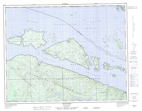
092L13 Shushartie Canada topo map, 1:50,000 scale
092L13 Shushartie NRCAN topographic map.
Includes UTM and GPS geographic coordinates (latitude and longitude). This 50k scale map is suitable for hiking, camping, and exploring, or you could frame it as a wall map.
Printed on-demand using high resolution, on heavy weight and acid free paper, or as an upgrade on a variety of synthetic materials.
Topos available on paper, Waterproof, Poly, or Tyvek. Usually shipping rolled, unless combined with other folded maps in one order.
- Product Number: NRCAN-092L13
- Parent Topo: TOPO-092L
- Map ID also known as: 092L13, 92L13
- Unfolded Size: Approximately 26" high by 36" wide
- Weight (paper map): ca. 55 grams
- Map Type: POD NRCAN Topographic Map
- Map Scale: 1:50,000
- Geographical region: British Columbia, Canada
Neighboring Maps:
All neighboring Canadian topo maps are available for sale online at 1:50,000 scale.
Purchase the smaller scale map covering this area: Topo-092L
Spatial coverage:
Topo map sheet 092L13 Shushartie covers the following places:
- Bull Harbour - Cascade Harbour - Harlequin Bay - Loquillilla Cove - Port Alexander - Queen Charlotte Sound - Roller Bay - Shushartie Bay - Ashby Point - Boxer Point - Cape James - Cholberg Point - Duval Point - Frankham Point - Godkin Point - Gorotisa Point - Greeting Point - Heath Point - Hougestol Point - Hussar Point - Jepther Point - Jones Point - Lemon Point - Magicienne Point - Mexicana Point - Mier Point - Nahwitti Point - Nolan Point - Pivot Point - Raglan Point - Scarlett Point - Secretary Point - Tommy Point - Bate Passage - Bolivar Passage - Browning Passage - Christie Passage - Goletas Channel - Gordon Channel - Queen Charlotte Strait - Ripple Passage - Shadwell Passage - Shelter Passage - Glen-gla-ouch Indian Reserve 5 - Hope Island Indian Reserve 1 - Réserve indienne Glen-gla-ouch 5 - Réserve indienne Hope Island 1 - Réserve indienne Wakems 6 - Wakems Indian Reserve 6 - Arm Islands - Balaklava Island - Bell Island - Blyth Islands - Boyle Island - Bright Island - Buckle Group - Centre Islet - Crane Islands - Duncan Island - Duval Island - Flat Island - Fraser Island - Gordon Group - Gordon Islands - Halsted Island - Halsted Islet - Heard Island - Hedley Islands - Herbert Island - Hope Island - Hosford Island - Hurst Island - Île de Vancouver - Jerome Island - Joan Island - Kalect Island - Kent Island - Knight Island - Lucan Islands - Nicholas Islands - Nicholas Islets - Nigei Island - Noble Islands - Noble Islets - Norman Island - One Tree Island - Onetree Islet - Philcox Island - Pine Island - Plover Island - Quoin Island - Race Island - Rason Island - Redfern Island - Saples Island - Shade Island - Slave Island - Southgate Group - Staples Island - Stick Island - Tinson Islands - Torrance Islet - Tree Islets - Vancouver Island - Vansittart Island - Walker Group - Wentworth Island - Wentworth Islet - Willes Island - Balaklava Lake - Brownie Lake - Erma Lake - Georgie Lake - Godkin Lake - Lake of the Mountains - Nahshutti Lake - Phyl Lake - Rannell Lake - Shushartie Lake - Songhees Lake - Ursie Lake - Meeson Cone - Mount Lemon - Shushartie Mountain - Regional District of Mount Waddington - God's Pocket Marine Park - Bragg Creek - Erma Creek - Godkin Creek - Nahshutti Creek - Nahwitti River - Phyl Creek - Rannell Creek - Shushartie River - Skinner Creek - Songhees Creek - Tyllia Creek - Ursie Creek - Alex Rock - Alleviation Rock - Annie Rocks - Approach Rock - Barge Rock - Bleach Rock - Breaker Reef - Cardigan Rocks - Croker Rock - Davey Rock - Dillon Rock - Farquhar Bank - George Rock - Hunt Rock - Jane Rock - Malpas Rock - Mouat Rock - Nahwitti Bar - Nye Rock - Prosser Rock - Ragged Rock - Roach Rock - Roller Reef - Scylla Rock - Simpson Rock - Sunken Rock - Sussex Reefs - Suwanee Rock - Tatnall Reefs - Thornton Reef - Tide Rock - Tribune Rock - Wentworth Rock - Bull Harbour - Shushartie - Shushartie Bay - Magin Saddle - Shushartie Saddle


