
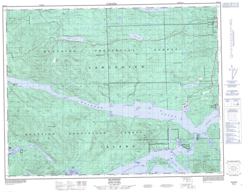
092L12 Quatsino Canada topo map, 1:50,000 scale
092L12 Quatsino NRCAN topographic map.
Includes UTM and GPS geographic coordinates (latitude and longitude). This 50k scale map is suitable for hiking, camping, and exploring, or you could frame it as a wall map.
Printed on-demand using high resolution, on heavy weight and acid free paper, or as an upgrade on a variety of synthetic materials.
Topos available on paper, Waterproof, Poly, or Tyvek. Usually shipping rolled, unless combined with other folded maps in one order.
- Product Number: NRCAN-092L12
- Parent Topo: TOPO-092L
- Map ID also known as: 092L12, 92L12
- Unfolded Size: Approximately 26" high by 36" wide
- Weight (paper map): ca. 55 grams
- Map Type: POD NRCAN Topographic Map
- Map Scale: 1:50,000
- Geographical region: British Columbia, Canada
Neighboring Maps:
All neighboring Canadian topo maps are available for sale online at 1:50,000 scale.
Purchase the smaller scale map covering this area: Topo-092L
Spatial coverage:
Topo map sheet 092L12 Quatsino covers the following places:
- Ahwhichaolto Inlet - Apple Bay - Atkins Cove - Bergh Cove - Coal Harbour - East Cove - Hecate Cove - Holberg Inlet - Jules Bay - Kokwina Cove - Koprino Harbour - Leeson Harbour - Neroutsos Inlet - Pamphlet Cove - Quatsino Sound - Robson Cove - Rupert Inlet - Spencer Cove - Varney Bay - Winter Harbour - Dahlstrom Point - Evenson Point - Hankin Point - Henriksen Point - Holloway Point - Kenny Point - Kultah Point - Lakken Point - Leeson Point - Lindgren Point - Michelsen Point - Mickelsen Point - Norton Point - Ohlsen Point - Sorenson Point - Stewart Point - Thorp Point - Quatsino Narrows - Port Hardy - Ah-we-cha-ol-to Indian Reserve 16 - Clatux Indian Reserve 9 - Clienna Indian Reserve 14 - Koprino Indian Reserve 10 - Kultah Indian Reserve 4 - Maquazneecht Island Indian Reserve 17 - Pa-cat'l-lin-ne Indian Reserve 3 - Pulcah Indian Reserve 15 - Quatsino Subdivision Indian Reserve 18 - Quattishe Indian Reserve 1 - Réserve indienne Ah-we-cha-ol-to 16 - Réserve indienne Clatux 9 - Réserve indienne Clienna 14 - Réserve indienne Koprino 10 - Réserve indienne Kultah 4 - Réserve indienne Maquazneecht Island 17 - Réserve indienne Pa-cat'l-lin-ne 3 - Réserve indienne Pulcah 15 - Réserve indienne Quatsino Subdivision 18 - Réserve indienne Quattishe 1 - Réserve indienne Toh-quo-eugh 2 - Réserve indienne Tsulquate 4 - Toh-quo-eugh Indian Reserve 2 - Tsulquate Indian Reserve 4 - Wazulis 14 - Cross Island - Diggs Islet - Dockyard Islet - Drake Island - Ildstad Islands - Ives Islet - Jesdal Islet - Kitten Island - Kitten Islet - Linthlop Islet - Makwazniht Island - Maquazneecht Island - Norgar Islet - Orr Island - Quatishe Island - Quattische Island - Schloss Island - Sherberg Island - Skedin Islet - Straggling Islands - Vancouver Island - Wedel Island - Botel Lake - Colony Lake - Early Bird Cove - Frances Lake - Georgie Lake - Isle Lake - Kains Lake - Nahwitti Lake - Quatse Lake - Holberg Mountain - Hushamu Mountain - Mount Byng - Mount Fannin - Nahwitti Mountain - Pemberton Hills - Vancouver Island Mountains - Vancouver Island Ranges - Woodward Peak - Regional District of Mount Waddington - Marble River Park - Absunstia Creek - Aweisha Creek - Bear Creek - Bish Creek - Bluebell Creek - Blumberg Creek - Caledonia Creek - Cascade Creek - Clesklagh Creek - Colony Creek - Denad Creek - Dick Booth Creek - Glenlion River - Glerup Creek - Goodspeed River - Hathaway Creek - Hawisnakwi Creek - Hepler Creek - Hushamu Creek - Jenkinson Creek - Kains Creek - Keekuyzed Creek - Kempson Creek - Klayina Creek - Koprino River - Kwokwesta Creek - Lower Ahwhichaolto Creek - Marble River - McNiffe Creek - Mead Creek - Nahshutti Creek - Nahwitti River - Nookneemish Creek - Nordstrom Creek - Nuknimish Creek - Pegattem Creek - Pugh Creek - Quashtin Creek - Quatse River - Simpson Creek - Stephens Creek - Tsulquate River - Upper Ahwhichaolto Creek - Wakalish Creek - Walkaleesh Creek - Wanokana Creek - Wanokanah Creek - Youghpan Creek - Akre Rocks - Allan Bank - Glerup Rock - Jones Rock - Leeson Rock - McNiffe Rock - Newcomb Rocks - Newcombe Rocks - Percy Ledge - Pot Rock - Coal Harbour - Quatsino


