
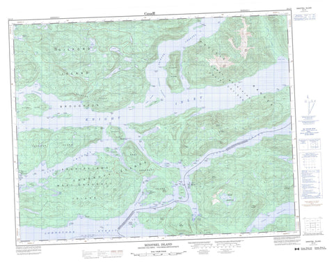
092L09 Minstrel Island Canada topo map, 1:50,000 scale
092L09 Minstrel Island NRCAN topographic map.
Includes UTM and GPS geographic coordinates (latitude and longitude). This 50k scale map is suitable for hiking, camping, and exploring, or you could frame it as a wall map.
Printed on-demand using high resolution, on heavy weight and acid free paper, or as an upgrade on a variety of synthetic materials.
Topos available on paper, Waterproof, Poly, or Tyvek. Usually shipping rolled, unless combined with other folded maps in one order.
- Product Number: NRCAN-092L09
- Parent Topo: TOPO-092L
- Map ID also known as: 092L09, 92L9, 92L09
- Unfolded Size: Approximately 26" high by 36" wide
- Weight (paper map): ca. 55 grams
- Map Type: POD NRCAN Topographic Map
- Map Scale: 1:50,000
- Geographical region: British Columbia, Canada
Neighboring Maps:
All neighboring Canadian topo maps are available for sale online at 1:50,000 scale.
Purchase the smaller scale map covering this area: Topo-092L
Spatial coverage:
Topo map sheet 092L09 Minstrel Island covers the following places:
- Bones Bay - Boughey Bay - Burial Cove - Call Inlet - Caution Cove - Chop Bay - Cracroft Inlet - Cutter Cove - Echo Bay - Felix Bay - Forward Bay - Gilford Bay - Hadley Bay - Lagoon Cove - Levesque Bay - Little Bay - Lull Bay - Maple Bay - Maple Cove - Open Cove - Port Elizabeth - Port Harvey - Port Harvey Harbour - Port Neville - Shelter Cove - Shoal Harbour - Soderman Cove - Tsakonu Cove - Turnour Bay - Air Point - Bamber Point - Bennett Point - Bockett Point - Boulder Point - Cleave Point - Domville Point - Gilford Point - Harvey Point - July Point - Littleton Point - Malone Point - Montagu Point - Nicholas Point - Prominent Point - Protection Point - Pumish Point - Ray Point - Robbers Knob - Robbers Nob - Root Point - Sambo Point - Shelterless Point - Squire Point - Steep Head - Steep Point - Transit Point - Tribune Point - Turn Point - White Nob Point - Whitebeach Point - Chatham Channel - Clapp Passage - Clio Channel - Havannah Channel - Nickoll Passage - Sargeaunt Passage - The Blow Hole - Tribune Channel - Wilson Passage - Batt Bluff - Mist Bluff - Stormy Bluff - Apsagayu Indian Reserve 1A - Coffin Island Indian Reserve 3 - Etsekin Indian Reserve 1 - Karlukwees Indian Reserve 1 - Keecekiltum Indian Reserve 2 - Kyimla Indian Reserve 11 - Réserve indienne Apsagayu 1A - Réserve indienne Coffin Island 3 - Réserve indienne Etsekin 1 - Réserve indienne Karlukwees 1 - Réserve indienne Keecekiltum 2 - Réserve indienne Kyimla 11 - Réserve indienne Small Island 4 - Small Island Indian Reserve 4 - Amyes Island - Atchison Island - Bend Island - Bockett Islets - Bowers Islands - Braza Island - Broken Islands - Broughton Archipelago - Bush Islets - Cracroft Islands - Cutter Islet - Doctor Islets - Dorman Island - East Cracroft Island - Farquharson Island - Gilford Island - Green Island - Green Islet - Grogan Island - Havannah Islets - Hazel Island - Hull Island - Indian Islands - Jamieson Island - Joliffe Island - Kamano Island - Klaoitsis Island - Kumlah Island - Lady Islands - Lily Islet - Lord Islet - Martin Islands - Martin Islets - Minstrel Island - Mist Islets - Mistake Island - Perley Island - Range Island - Rest Islets - Round Island - Shewell Island - Tide Pole Islet - Tom Islet - Triangle Island - Turnour Island - Viscount Island - Warren Islands - West Cracroft Island - Battle Lake - Bridie Lake - Findlay Lake - Fraser Lake - Fulmore Lake - Gilford Lake - Potts Lagoon - Bare Mountain - Burnt Mountain - Chaîne Côtière - Coast Mountains - Collingwood Mount - Georgina Range - Mount Anthony - Mount Antony - Mount Falkner - Mount Frederic - Mount Gosset - Mount Haig - Mount Hawkins - Mount James - Mount Nelson - Mount Summerfield - Mount Thomas - Mount Victory - Nelson Ridge - Pacific Ranges - Snow Mountain - Victory Mountain - Regional District of Mount Waddington - Echo Bay Marine Park - Bones Creek - Call Creek - Gilford Creek - Lull Creek - Boughey Shoal - Browning Rock - Call Shoal - Channel Rock - Escape Reef - Hull Rock - Humphrey Rock - Negro Rock - Turnour Rock - Bones Bay - Cracroft - Kalukwees - Karlukwees - Matilpi - Minstrel Island


