
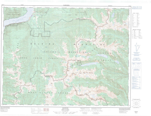
082F13 Burton Canada topo map, 1:50,000 scale
082F13 Burton NRCAN topographic map.
Includes UTM and GPS geographic coordinates (latitude and longitude). This 50k scale map is suitable for hiking, camping, and exploring, or you could frame it as a wall map.
Printed on-demand using high resolution, on heavy weight and acid free paper, or as an upgrade on a variety of synthetic materials.
Topos available on paper, Waterproof, Poly, or Tyvek. Usually shipping rolled, unless combined with other folded maps in one order.
- Product Number: NRCAN-082F13
- Parent Topo: TOPO-082F
- Map ID also known as: 082F13, 82F13
- Unfolded Size: Approximately 26" high by 36" wide
- Weight (paper map): ca. 55 grams
- Map Type: POD NRCAN Topographic Map
- Map Scale: 1:50,000
- Geographical region: British Columbia, Canada
Neighboring Maps:
All neighboring Canadian topo maps are available for sale online at 1:50,000 scale.
Purchase the smaller scale map covering this area: Topo-082F
Spatial coverage:
Topo map sheet 082F13 Burton covers the following places:
- Caribou Point - The Narrows - New Denver Glacier - Goose Island - Avis Lakes - Beatrice Lake - Bunny Lake - Cahill Lake - Cooper Lake - Coven Lakes - Demers Lakes - Drinnan Lake - Drinnon Lake - Evans Lake - Fosheim Lake - Grassy Lake - Gwillim Lakes - Hird Lakes - Lower Arrow Lake - McKean Lakes - Mulvey Lakes - Purney Lake - Reanay Lakes - Rocky Lakes - Thor Lake - Tracy Cooper Lake - Valhalla Lake - Wee Sandy Lake - Asgard Peak - Banshee Peak - Chariot Peak - Columbia Mountains - Demers Peak - Devils Couch - Devils Dome - Devils Range - Devils Spire - Drinnan Peak - Drinnon Peak - English Peak - Gimli - Gimli Peak - Gladsheim Peak - Golden Hope Peak - Gray Wolf Mountain - Gregorio Peak - Grey Wolf Mountain - Hailstorm Peak - Hailstorm Ridge - Hela Peak - Hilda Peak - Lucifer Peak - Midgard Peak - Monashee Mountains - Mount Bor - Mount Dag - Mount Denver - Mount Diablo - Mount Dorval - Mount Harlow - Mount Lequereux - Mount Marshall - Mount McBride - Mount McKean - Mount Meers - Mount Mephistopheles - Mount Niord - Mount Prestley - Mount Prough - Mount Rollins - Mount Shardelow - Naumulten Mountain - Niord Mountain - Satan Peak - Selkirk Mountains - Slocan Ranges - Tillicum Mountain - Trident Peak - Urd Peak - Valhalla Mountains - Valhalla Range - Valhalla Ranges - Valkyr Mountains - Valkyr Range - Warner Ridge - Woden Peak - Wolfs Ears - Arrow Lakes Park - Valhalla Park - Bannock Burn - Beatrice Creek - Burton (Trout) Creek - Caribou Creek - Columbia River - Cony Creek - Dago Creek - Evans Creek - Fauquier Creek - Fleuve Columbia - Goatcanyon Creek - Gwillim Creek - Hail Creek - Hall Creek - Heart Creek - Hoder Creek - Ice Creek - Indian Creek - Joye Creek - Koch Creek - Londonderry Creek - Mulvey Creek - Nemo Creek - Snow Creek - Snowslide Creek - Stoney Creek - Taite Creek - Wee Sandy Creek - Woden Creek - Belleview - Burton


