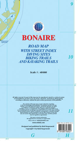
Bonaire : road map with street index diving sites biking trails and kayaking trails
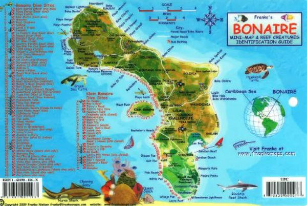
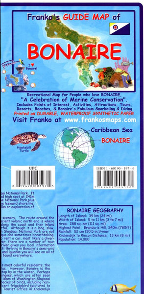
This is currently (2016) the most up-to-date and only complete road map of Bonaire (Scale 1 : 40 000), as well as the Kralendijk urban area, spanning from Santa Barbara Crowns, through the airport, and all the way to Punt Vierkant (Scale 1 : 15 000). An inset of Rincon (Scale 1 : 12 000) is also included. All maps and insets come with thorough street indexes obtained from our surveys and local government agencies. *** The map shows all the islands known roads and streets with their names, as well as an extensive set of biking routes and kayaking trails. *** ALL OFFICIAL DIVING SITES around Bonaire and Klein Bonaire are displayed, most with their GPS locations, as recorded by STINAPA, the islands official conservation foundation. *** The map is sold folded, measuring 5 1/4 x 9 5/8 ( 13.5 cm x 24.5 cm ) and is designed for easy opening and refolding. Its full unfolded format is 26 x 38 5/8 ( 66 cm x 98 cm ). The map can also be hung on a wall to show the entire island. It offers ri
- Product Number: KAS_BONAIRE_16
- Reference Product Number: 2226210M
- ISBN: 9791095793021
- Date of Publication: 6/1/2016
- Folded Size: 9.84 inches high by 5.24 inches wide
- Unfolded (flat) Size: 26.38 inches high by 38.58 inches wide
- Map format: Folded
- Map type: Trade Maps - Road
- Geographical region: Bonaire, Sint Eustatius and Saba