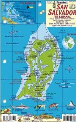
Bahamas Fish Card, San Salvador Island 2011 by Frankos Maps Ltd.
Perfect for divers, snorkelers and nature lovers! Side One is a mini-map of San Salvador, The Bahamas, site of the first New World landfall by Christopher Columbus on October 12, 1492. Dive sites are named and located. Side Two is a fish identification guide with nearly 100 species illustrated. This convenient, waterproof reference is made of hard, laminated plastic with hole for lanyard. 5.5 x 8.5
- Product Number: 2043043M
- Product Code: FM_SANSAL_FISH
- ISBN: 9781601903518
- Year of Publication: 2011
- Unfolded Size: 8.46 x 5.51 inches
- Map type: Flat Map
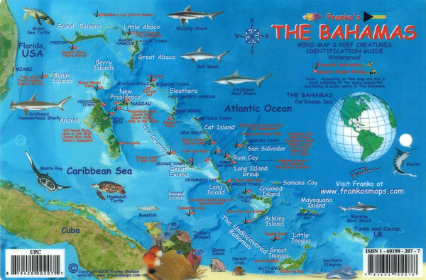
- Geographical region: Bahamas