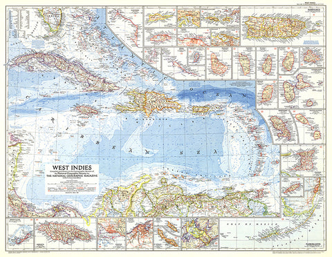
1954 West Indies Map
This colorful map of the West Indies contains thirty inset maps providing spectacular detail of the many islands in the Caribbean. Published in March 1954 with two articles, Jamaica - Hub of the Caribbean and Night Life in the Gulf Stream.
- Product Number: PODHNG_W_IND_54
- Reference Product Number: 2321545M
- ISBN: - None -
- Date of Publication: 6/1/1954
- Unfolded (flat) Size: 29 inches high by 37.25 inches wide
- Map format: Wall
- Map type: Trade Maps - Political
- Geographical region: Bahamas,Barbados,Colombia,Costa Rica,Cuba,Dominica,Grenada,Guadeloupe,Haiti,Jamaica,Martinique,Nicaragua,Puerto Rico,Saint Barthelemy,Saint Kitts and Nevis,Saint Lucia,Saint Martin,Saint Vincent and the Grenadines,United States,Venezuela