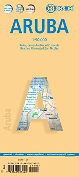
Aruba, Oranjestad and San Nicolas
Laminated, waterproof tourist map of Aruba from Borch, with street plans of Oranjestad and San Nicolas. The main map at 1:50,000 shows the boundaries of the Arikok National Park and highlights numerous places of interest, including beaches, shipwrecks, windsurfing and snorkeling sites, as well as information centres, petrol supplies, etc. The island’s topography is shown by relief shading with spot heights and road network includes unsurfaced country tracks. No geographical coordinates are provided. The map is supplemented by two insets with the whole of the Lesser Antilles at 1:7,000,000 and the ABC Islands (Aruba, Bonaire and Curaçao) at 1:1,000,000.
On the reverse there are street plans of Oranjestad (1:10,000) and the area north of it with the island’s main beaches (1:25,000), plus of the southern tip of Aruba with San Nicolas (1:20,000), highlighting places of interest and various facilities. All the maps and the street plans are indexed, with separate lists for accommodat
- Product Number: BOR_ARU_23
- Reference Product Number: - None -
- ISBN: 9783866093423
- Date of Publication: 6/15/2023
- Folded Size: 9.45 inches high by 4.33 inches wide
- Unfolded (flat) Size: 19.29 inches high by 25.98 inches wide
- Map format: Folded
- Map type: Trade Maps - Travel
- Geographical region: Aruba