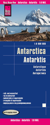
Antarctica Political Reference Map
Antarctica at 1:8,000,000 on a folded, waterproof and tear-resistant map from Reise Know-How with plenty of topographic information, prominent highlighting of the continent’s by now numerous research stations, penguin breeding grounds, territorial claims, routes of famous expeditions, etc.
The map presents Antarctica’s topography by contours and numerous spot heights, plus plenty of names of mountain ranges, peaks, glaciers, coastal bays, ice shelves, etc. Boundaries of various territorial claims are shown in different colours and locations of permanent or seasonal research stations and encampments are prominently highlighted by national flags; the stations are also annotated with their founding year. The map shows breeding grounds of the emperor and adelie penguins, airstrips and helipads, and the points of southern pole of inaccessibility, South Geomagnetic Pole and the South Magnetic Pole. Expeditions routes marked on the map include those of Amundsen and Scott in 1911, as well
- Product Number: RKH_ANT_20
- Reference Product Number: - None -
- ISBN: 9783831774388
- Date of Publication: 6/1/2020
- Folded Size: 10.24 inches high by 4.72 inches wide
- Unfolded (flat) Size: 27.56 inches high by 39.37 inches wide
- Map format: Folded
- Map type: Trade Maps - Travel
- Geographical region: Antarctica