Free Shipping on map orders over $300
Iles de la Societe, de Manuae a Tahiti by SHOM
Iles de Port-Cros et du Levant (Iles dHyeres) by SHOM
Iles du Salut by SHOM
Iles Futuna et Alofl by SHOM
Iles Gambler by SHOM
Iles Gambler, partie Sud by SHOM
Iles Kerguelen - Golfe du Morbihan (partie Quest) by SHOM
Iles Kerguelen - Golfe du Morbihan - Partie Est by SHOM
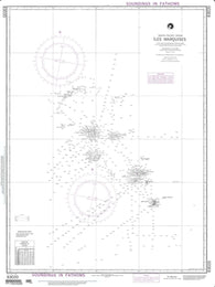
Iles Marquises (Fenua Enata) by SHOM
Iles Marquises (NGA-83020-8) by National Geospatial-Intelligence Agency
Iles Rimatara et Maria by SHOM
Iles Saint-Paul by SHOM
Iles Saint-Paul et Amsterdam - Mouillage de Iles Saint-Paul by SHOM
Iles Saint-Pierre et Miquelon by SHOM
Iles Sainte-Marie a/to Ile a La Brume by Canadian Hydrographic Service
Iles Salnt-Paul et Amsterdam by SHOM
Iles Tuamotu (partie centrale) de Makemo a Tatakoto by SHOM
Iles Tuamotu (partie Est) de Hao a Fangataufa by SHOM
Iles Tuamotu (partie Quest), de Tahiti a Rangiroa et Makemo by SHOM
Iles Wallis - Acces a Mata Utu et Halalo by SHOM
Iles Wallis by SHOM
Ilha De Santa Catarina To Maldonado (NGA-24000-39) by National Geospatial-Intelligence Agency
Illinois Atlas and Gazetteer
Illinois Atlas and Gazetteer by DeLorme
Illinois by Rand McNally
Illinois GuideMap by National Geographic Maps
Illinois River (Starved Rock to Hennepin) Fishing Map
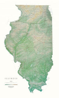
Illinois [Physical, 55x33, Laminated]
Illinois [Physical, 55x33]
Illinois, Easy to Fold
Illinois, Easy to Fold by Rand McNally
Illinois, Physical Wall Map by Raven Maps
Illinois, Physical, Laminated Wall Map by Raven Maps
Illinois, Southern, Back Roads by GM Johnson
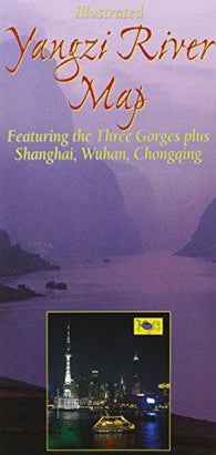
Illustrated Yangzi River map : featuring the Three Gorges plus Shanghai, Wuhan, Chongqing
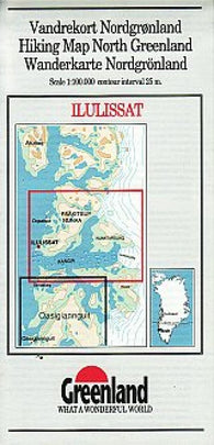
Ilulissat hiking map
Imperia : carta della provincia : scala 1:100.000
Imperia Province, Italy by Litografia Artistica Cartografica


![Buy map Illinois [Physical, 55x33, Laminated]](http://store.yellowmaps.com/cdn/shop/products/big_8481b483-d660-4c9b-8e42-c46d333b57da_195x.jpg?v=1706819368)
![Buy map Illinois [Physical, 55x33]](http://store.yellowmaps.com/cdn/shop/products/big_dbc46cd0-5f6f-4fce-abfd-7b845840e274_195x.jpg?v=1706819370)