Free Shipping on map orders over $300
Chemin Portugais - French Edition
Chemnitz 1:250 000, blatt 20
Chemung and Steuben Counties, New York by Jimapco
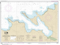
Chenal du Bic et les approches/and approaches by Canadian Hydrographic Service
Chenal du Havre de la Grande Entrée by Canadian Hydrographic Service
Chenal Vasia by SHOM
Chepang Hills Trail, Chitwan National Park, Nepal
Chequamegon Bay-Superior Fishing Map (Ashland/Bayfield Co)
Chequamegon Nicolet National Forest - East half map
Chequamegon Waters-Miller Dam Flowage (Taylor Co) Fishing Map
Cher, Indre (323) by Michelin Maps and Guides
Chernofski Harbor (16516-8) by NOAA
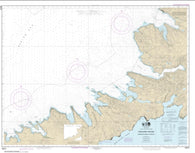
Chernofski Harbor to Skan Bay (16515-8) by NOAA
Cherokee and Pisgah Nat. Forests: South Holston and Watauga Lakes, Map 783 by National Geographic Maps
Cherokee and Pisgah National Forests by National Geographic Maps
Cherokee Lake (Tennessee) Fish Map
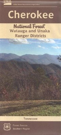
Cherokee National Forest (North) - Watauga and Unaka Ranger Districts Map
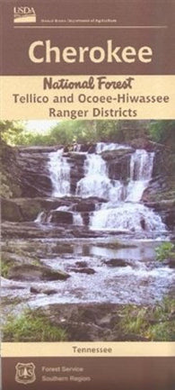
Cherokee National Forest (South) - Tellico and Ocoee-Hiwassee Ranger Districts Map
Cherokee National Forest [Map Pack Bundle]
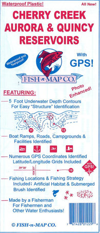
Cherry Creek, Aurora, & Quincy Reservoirs Fishing Map
Ches Route (Spanish edition) by deDios
Ches Route by deDios
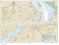
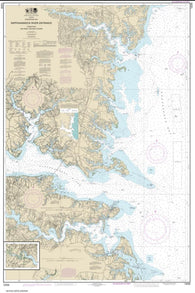
Chesapeake and Delaware Canal (12277-36) by NOAA
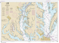
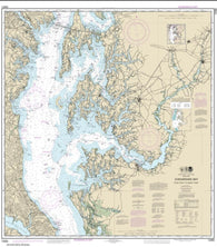
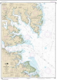
Chesapeake Bay (12280-11) by NOAA
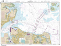
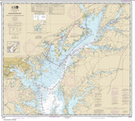
Chesapeake Bay Approaches to Baltimore Harbor (12278-79) by NOAA
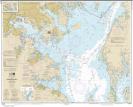
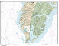
Chesapeake Bay Cape Charles to Norfolk Harbor (12222-55) by NOAA
Chesapeake Bay Cape Charles to Wolf Trap (12224-26) by NOAA
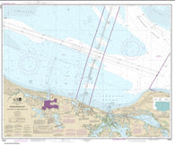
Chesapeake Bay Cape Henry to Thimble Shoal Light (12254-49) by NOAA
Chesapeake Bay Choptank River and Herring Bay; Cambridge (12266-31) by NOAA
Chesapeake Bay Cove Point to Sandy Point (12263-56) by NOAA
Chesapeake Bay Eastern Bay and South River; Selby Bay (12270-36) by NOAA
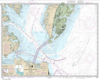
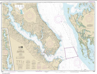
Chesapeake Bay Entrance (12221-82) by NOAA
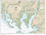
Chesapeake Bay Honga, Nanticoke, Wicomico Rivers and Fishing Bay (12261-30) by NOAA
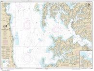
Chesapeake Bay Mobjack Bay and York River Entrance (12238-41) by NOAA
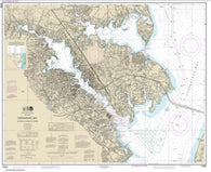
Chesapeake Bay Patuxent River and Vicinity (12264-32) by NOAA
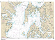
Chesapeake Bay Pocomoke and Tangier Sounds (12228-33) by NOAA
Chesapeake Bay Rappahannock River Entrance, Piankatank and Great Wicomico Rivers (12235-34) by NOAA
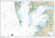
Chesapeake Bay Sandy Point to Susquehanna River (12273-59) by NOAA
Chesapeake Bay Severn and Magothy Rivers (12282-36) by NOAA


![Buy map Cherokee National Forest [Map Pack Bundle]](http://store.yellowmaps.com/cdn/shop/products/TI_CHEROKEE_NF_BUNDLE_20_large_8c89f67f-345f-4f99-8d6b-e919e6127a37_195x.jpg?v=1706907198)