Free Shipping on map orders over $300
Cape Canso to/a Country Island by Canadian Hydrographic Service
Cape Charles Inshore - Fishermans Island to Chincoteague Inlet
Cape Churchill to/a Egg River by Canadian Hydrographic Service
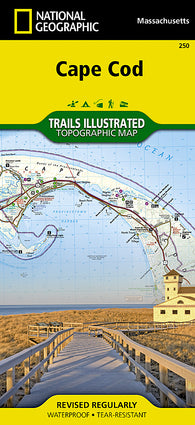
Cape Cod ,Coastal Recreation, Map 250 by National Geographic Maps
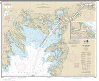
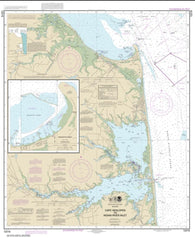
Cape Cod Bay (13246-40) by NOAA
Cape Cod Bay Fishing Map
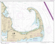
Cape Cod Canal and Approaches (13236-31) by NOAA
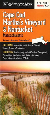
Cape Cod, Marthas Vineyard and Nantucket, Massachusetts by Kappa Map Group
Cape Cod, Massachusetts
Cape Cod, Massachusetts by GM Johnson
Cape Cod, Massachusetts by The Seeger Map Company Inc.
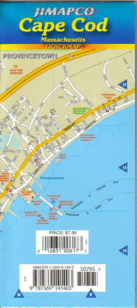
Cape Cod, Massachusetts, Quickmap by Jimapco
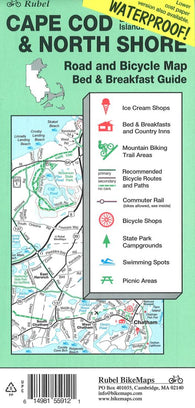
Cape Cod, The Islands and North Shore, Road and Bicycle Map (waterproof) by Rubel BikeMaps
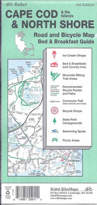
Cape Cod, The Islands and North Shore, Road and Bicycle Map by Rubel BikeMaps
CAPE COLVILLE TO GREAT MERCURY ISLAND (AHUAHU) INCLUDING CUVIER ISLAND (REPANGA ISLAND) (5312) by Land Information New Zealand (LINZ)
Cape Cook to Cape Scott by Canadian Hydrographic Service
Cape Daly to/a Amiktok Island by Canadian Hydrographic Service
Cape Dorchester to Spicer Islands by Canadian Hydrographic Service
Cape Dorset and Approaches by Canadian Hydrographic Service
Cape Dufferin to/a Broughton Island by Canadian Hydrographic Service
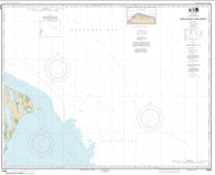
Cape Dyer to Cape Lisburge (16122-6) by NOAA
Cape Edward to Lisianski Strait, Chichagof Island (17321-10) by NOAA
CAPE EGMONT TO RANGITIKEI RIVER (45) by Land Information New Zealand (LINZ)
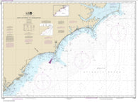
Cape Elizabeth to Portsmouth; Cape Porpoise Harbor; Wells Harbor; Kennebunk River; Perkins Cove (13286-32) by NOAA
Cape Fear River Cape Fear to Wilmington (11537-40) by NOAA
Cape Flattery (18485-17) by NOAA
CAPE FOULWIND TO HERETANIWHA POINT (72) by Land Information New Zealand (LINZ)
Cape Freels to/a Exploits Islands by Canadian Hydrographic Service
Cape Gargantua to/a Otter Head by Canadian Hydrographic Service
Cape George to/a Pictou by Canadian Hydrographic Service
Cape Halkett and vicinity (16065-7) by NOAA
Cape Harrigan to/aux Kitlit Islands by Canadian Hydrographic Service
Cape Harrison to/a Dog Islands by Canadian Hydrographic Service
Cape Harrison to/a Nunaksaluk Island by Canadian Hydrographic Service
Cape Harrison to/a St. Michael Bay by Canadian Hydrographic Service
Cape Hatteras to Charleston (11520-45) by NOAA
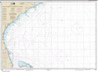
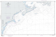
Cape Hatteras to Straits of Florida (11009-39) by NOAA
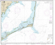
Cape Hatteras-Wimble Shoals to Ocracoke Inlet (11555-41) by NOAA
Cape Henlopen to Indian River Inlet; Breakwater Harbor (12216-29) by NOAA
Cape Henry To Cape Race (NGA-14003-6) by National Geospatial-Intelligence Agency