Free Shipping on map orders over $300
by Canadian Hydrographic Service
Byan Martin Channel to/au Maclean Strait by Canadian Hydrographic Service
Bylot Island and Adjacent Channels by Canadian Hydrographic Service
Byng Inlet and Approaches/et les Approches by Canadian Hydrographic Service
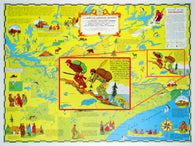
C-1: OLD VOYAGEURS HIGHWAY MAP
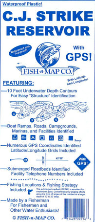
C.J. Strike Reservoir, Idaho Fishing Map
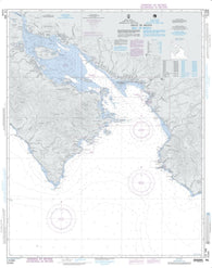
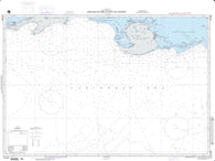
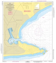
C.R. 006, Gulf Of Nicoya (NGA-21544-20) by National Geospatial-Intelligence Agency
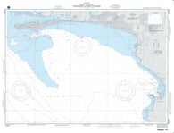
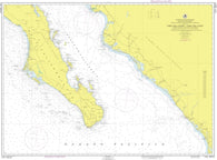
C.R. 008, Puntarenas And Puerto Caldera (NGA-21546-3) by National Geospatial-Intelligence Agency
Caamano Sound and Approaches/et les Approches by Canadian Hydrographic Service
Cabin Islands to/aux Pilot Islands by Canadian Hydrographic Service
Cabo Cruz To Santiago De Cuba Including Jamaica (NGA-26220-6) by National Geospatial-Intelligence Agency
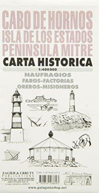
Cabo de Hornos : Isla de los Estados : peninsula mitre : carta historica
Cabo De San Francisco To Paita (NGA-22004-38) by National Geospatial-Intelligence Agency
Cabo Farallones To Tela; Plan A (NGA-28150-3) by National Geospatial-Intelligence Agency
Cabo Frances To Punta Las Cayamas (NGA-27141-5) by National Geospatial-Intelligence Agency
Cabo Frances To Punta Nisibon (NGA-25710-2) by National Geospatial-Intelligence Agency
Cabo Gracias A Dios To Puerto Isabel (NGA-28130-1) by National Geospatial-Intelligence Agency
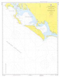
Cabo Matapalo To Morro De Puercos (NGA-21580-40) by National Geospatial-Intelligence Agency
Cabo San Antonio To Cayo Del Rosario (NGA-27130-2) by National Geospatial-Intelligence Agency
Cabo San Lazaro a Cabo San Lucas by Secretaria de Marina
Cabo San Lazaro a Isla Creciente, B.C.S. by Secretaria de Marina
Cabo San Lazaro To Cabo San Lucas (NGA-21014-72) by National Geospatial-Intelligence Agency
Cabo San Lucas a Manzanillo e Islas Revillagigedo by Secretaria de Marina
Cabo San Lucas To Manzanillo (NGA-21017-50) by National Geospatial-Intelligence Agency
Cabo San Lucas, B.C.S. by Secretaria de Marina
Cabo San Quinton To Punta Eugenia (NGA-21005-5) by National Geospatial-Intelligence Agency
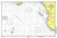
Cabo Velas To Cabo Blanco, Costa Rica (NGA-21550-1) by National Geospatial-Intelligence Agency
Cabot Strait and Approaches/Detroit de Cabot et les Approches, Scatarie Island to/a Anticosti Island/Ile DAnticosti by Canadian Hydrographic Service
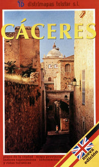
Caceres City Map
Caceres, Spain by Distrimapas Telstar, S.L.
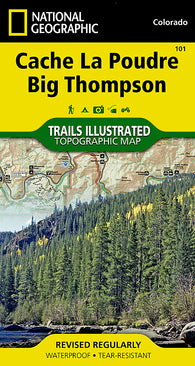
Cache La Poudre and Big Thompson, Colorado, Map 101 by National Geographic Maps
Cachuma Lake Fishing Map
Caddo Lake Fishing Map
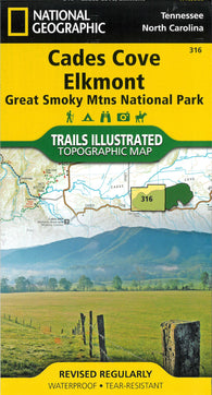
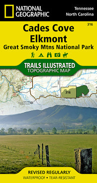
Cade Cove Elkmont : Great Smoky Mtns National Park : Tennessee & North Carolina, USA
Cades Cove, Great Smoky Mountains National Park, Map 316 by National Geographic Maps