
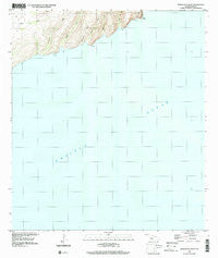
~ Honuaula Valley HI topo map, 1:24000 scale, 7.5 X 7.5 Minute, Historical, 1989, updated 2001
Honuaula Valley, Hawaii, USGS topographic map dated 1989.
Includes geographic coordinates (latitude and longitude). This topographic map is suitable for hiking, camping, and exploring, or framing it as a wall map.
Printed on-demand using high resolution imagery, on heavy weight and acid free paper, or alternatively on a variety of synthetic materials.
Topos available on paper, Waterproof, Poly, or Tyvek. Usually shipping rolled, unless combined with other folded maps in one order.
- Product Number: USGS-5643706
- Free digital map download (high-resolution, GeoPDF): Honuaula Valley, Hawaii (file size: 6 MB)
- Map Size: please refer to the dimensions of the GeoPDF map above
- Weight (paper map): ca. 55 grams
- Map Type: POD USGS Topographic Map
- Map Series: HTMC
- Map Verison: Historical
- Cell ID: 395530
- Scan ID: 349305
- Imprint Year: 2001
- Woodland Tint: Yes
- Aerial Photo Year: 1989
- Datum: NAD83
- Map Projection: Universal Transverse Mercator
- Map published by United States Geological Survey
- Map Language: English
- Scanner Resolution: 600 dpi
- Map Cell Name: Honuaula Valley
- Grid size: 7.5 X 7.5 Minute
- Date on map: 1989
- Map Scale: 1:24000
- Geographical region: Hawaii, United States
Neighboring Maps:
All neighboring USGS topo maps are available for sale online at a variety of scales.
Spatial coverage:
Topo map Honuaula Valley, Hawaii, covers the geographical area associated the following places:
- Kalaoa Bay - Waiapuaa Valley - Honua‘ula Valley - Pueo Point - Kalaoa Beach - Ka‘ailana Valley - Kanouli Valley - Kalaoa Valley - Kalaoa Stream - Hanakamanene Valley - Pali Paia - Nōmilu Valley - ‘Awāwalua Valley
- Map Area ID: AREA21.921.7666667-160.1583333-160.0333333
- Northwest corner Lat/Long code: USGSNW21.9-160.1583333
- Northeast corner Lat/Long code: USGSNE21.9-160.0333333
- Southwest corner Lat/Long code: USGSSW21.7666667-160.1583333
- Southeast corner Lat/Long code: USGSSE21.7666667-160.0333333
- Northern map edge Latitude: 21.9
- Southern map edge Latitude: 21.7666667
- Western map edge Longitude: -160.1583333
- Eastern map edge Longitude: -160.0333333


