
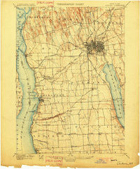
~ Auburn NY topo map, 1:62500 scale, 15 X 15 Minute, Historical, 1902
Auburn, New York, USGS topographic map dated 1902.
Includes geographic coordinates (latitude and longitude). This topographic map is suitable for hiking, camping, and exploring, or framing it as a wall map.
Printed on-demand using high resolution imagery, on heavy weight and acid free paper, or alternatively on a variety of synthetic materials.
Topos available on paper, Waterproof, Poly, or Tyvek. Usually shipping rolled, unless combined with other folded maps in one order.
- Product Number: USGS-5450513
- Free digital map download (high-resolution, GeoPDF): Auburn, New York (file size: 7 MB)
- Map Size: please refer to the dimensions of the GeoPDF map above
- Weight (paper map): ca. 55 grams
- Map Type: POD USGS Topographic Map
- Map Series: HTMC
- Map Verison: Historical
- Cell ID: 50790
- Scan ID: 139188
- Visual Version Number: 1
- Survey Year: 1896
- Datum: Unstated
- Map Projection: Unstated
- Map published by United States Geological Survey
- Map Language: English
- Scanner Resolution: 600 dpi
- Map Cell Name: Auburn
- Grid size: 15 X 15 Minute
- Date on map: 1902
- Map Scale: 1:62500
- Geographical region: New York, United States
Neighboring Maps:
All neighboring USGS topo maps are available for sale online at a variety of scales.
Spatial coverage:
Topo map Auburn, New York, covers the geographical area associated the following places:
- Shumaker Crossing - Union Springs - Owasco Lake Station - Bunker - Throop - Auburn - Bennett's Mobile Court - Cayuga Junction - Fosterville - Powers Corner - Wyckoff - Sherwood - Sawyers Corner - Mapleton - Highland Beach - Sherlock Corners - Half Acre - Cross Roads - Fleming - Levanna - Ensenore - Canoga - Johnson Mobile Home Park South - Elmwood - Petty Corner - Mud Lock - Relius - Southern Springs Mobile Home Park - Throopsville - Cayuga - Conklin Cove - Sennett - Moraine Manor Mobile Home Park - Scipio Center - Merrifield - Scipioville - Melrose Park - Aurora - Farleys - Cooper's Mobile Home Park - Oakwood - Cold Spring
- Map Area ID: AREA4342.75-76.75-76.5
- Northwest corner Lat/Long code: USGSNW43-76.75
- Northeast corner Lat/Long code: USGSNE43-76.5
- Southwest corner Lat/Long code: USGSSW42.75-76.75
- Southeast corner Lat/Long code: USGSSE42.75-76.5
- Northern map edge Latitude: 43
- Southern map edge Latitude: 42.75
- Western map edge Longitude: -76.75
- Eastern map edge Longitude: -76.5


