Tibet : township map & place name index : designed and edited by Tsering Wangyal Shawa
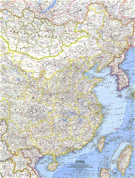
The Tibet Township map and place name index is based on the 2000 Chinese township population census data. The map and place name index includes all the townships that are within the Tibet Autonomous Region, Tibetan Autonomous Prefectures and Counties in Qinghai, Sichuan, Yunnan, and Gansu. It also includes Tsoshar (Haidong Prefecture) and Xining, a prefecture-level city, in Qinghai because they have large Tibetan populations. The international boundaries are based on
actual lines of control rather than claimed territories.
The Township place name index is written in three scripts: Tibetan, Chinese, and English as well as in Pinyin (Romanization standard for Chinese script), Wylie (standard transliteration of Tibetan script in scholarly literature in the English world), and the phonetic Tibetan for a general user to sound out Tibetan town names.
The goals of this map and place name index are to capture as many place names that were and are Tibetan names as possible. The
- Product Number: TWS_TIBET_14
- Reference Product Number: 2172763M
- ISBN: 9780692292921
- Date of Publication: 6/1/2014
- Folded Size: 9.84 inches high by 5.91 inches wide
- Unfolded (flat) Size: 57.87 inches high by 39.76 inches wide
- Map format: Folded
- Map type: Trade Maps - Political
- Geographical region: China
- Geographical subregion: Xizang A. R.