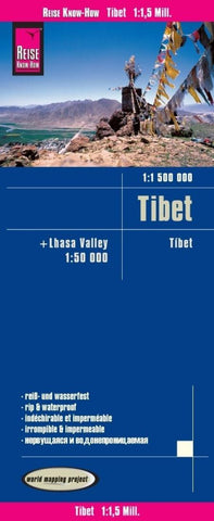
Tibet + Lhasa Valley = Tíbet
Reise Know-How maps (world mapping project series) are easy-to-read, waterproof and highly durable travel maps specifically designed for everyday use on the road.
Our maps combine state-of-the-art, GPS-compatible cartography (including hypsometric tints and contour lines) with a detailed rendering of road networks and touristic information. They offer the best possible scale, level of detail and readability, be it a map of a small island or half a continent.
The maps feature a detachable paper sleeve so that the maps can be folded easily and fit in every pocket. Although printed on plastic, a special coating makes sure the maps retain a paper-like feel and can even be written on with a pencil.
- Product Number: RKH_TIBET_17
- Reference Product Number: 2253089M
- ISBN: 9783831773947
- Date of Publication: 6/1/2017
- Folded Size: 4.72 inches high by 10.24 inches wide
- Unfolded (flat) Size: 39.37 inches high by 27.56 inches wide
- Map format: Folded
- Map type: Trade Maps - Road
- Geographical region: China
- Geographical subregion: Xizang A. R.

