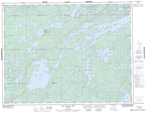
052F16 Big Sandy Lake Canada topo map, 1:50,000 scale
052F16 Big Sandy Lake NRCAN topographic map.
Includes UTM and GPS geographic coordinates (latitude and longitude). This 50k scale map is suitable for hiking, camping, and exploring, or you could frame it as a wall map.
Printed on-demand using high resolution, on heavy weight and acid free paper, or as an upgrade on a variety of synthetic materials.
Topos available on paper, Waterproof, Poly, or Tyvek. Usually shipping rolled, unless combined with other folded maps in one order.
- Product Number: NRCAN-052F16
- Parent Topo: TOPO-052F
- Map ID also known as: 052F16, 52F16
- Unfolded Size: Approximately 26" high by 36" wide
- Weight (paper map): ca. 55 grams
- Map Type: POD NRCAN Topographic Map
- Map Scale: 1:50,000
- Geographical region: Ontario, Canada
Neighboring Maps:
All neighboring Canadian topo maps are available for sale online at 1:50,000 scale.
Purchase the smaller scale map covering this area: Topo-052F
Spatial coverage:
Topo map sheet 052F16 Big Sandy Lake covers the following places:
- Chicago Bay - Jackfish Bay - Lyons Bay - Pickerel Arm - Redpine Bay - Southwest Bay - Redpine Narrows - Moonlight Falls - Echo - Hartman - Jordan - Laval - Lomond - MacFie - McAree - McIlraith - Pickerel - Webb - Biscuit Island - Burnt Island - Seagull Island - Wild Pigeon Island - Anderson Lake - August Lake - Bark Lake - Basket Lake - Beartrack Lake - Big Sandy Lake - Big Vermilion Lake - Blackfox Lake - Boling Lake - Booger Lake - Botink Lake - Butterfly Lake - Cedarbough Lake - Cloudlet Lake - Cole Lake - Crossecho Lake - Currier Lake - Dallas Lake - Diamond Lake - Diene Lake - Franciscan Lake - Gardnar Lake - George Lake - Hamilton Lake - Hartman Lake - Hooch Lake - Jacobus Lake - July Lake - June Lake - Kabik Lake - Kabikwabik Lake - Kathlyn Lake - Keike Lake - Keikewabik Lake - Lapp Lake - Lateral Lake - Laval Lake - Little Vermilion Lake - Lose Lake - MacFie Lake - Maskinonge Lake - May Lake - McIvor Lake - Melgund Lake - Mickle Lake - Miles Lake - Minnitaki Lake - Misfit Lake - Muskie Lake - Philcot Lake - Redhat Lake - Sandybeach Lake - September Lake - Slough Lake - Swi Lake - Swimit Lake - Tablerock Lake - Talman Lake - Tom Chief Lake - Tot Lake - Troutfly Lake - Wabik Lake - Echo Township Wilderness Area - Lola Lake Provincial Nature Reserve - Ojibway Provincial Park - Beartrack Creek - Blackfox Creek - Centrefire Creek - Finlayson Creek - Franciscan Creek - Hooch Creek - Hooch Creek - Jackfish Creek - Laval Creek - MacFie Creek - Mickle Creek - Muskie Creek - Sandy River - Suzanne River - Tot Creek - Twinflower Creek - Blackface Portage - Submarine Rock - Sioux Lookout


