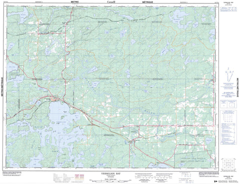
052F14 Vermilion Bay Canada topo map, 1:50,000 scale
052F14 Vermilion Bay NRCAN topographic map.
Includes UTM and GPS geographic coordinates (latitude and longitude). This 50k scale map is suitable for hiking, camping, and exploring, or you could frame it as a wall map.
Printed on-demand using high resolution, on heavy weight and acid free paper, or as an upgrade on a variety of synthetic materials.
Topos available on paper, Waterproof, Poly, or Tyvek. Usually shipping rolled, unless combined with other folded maps in one order.
- Product Number: NRCAN-052F14
- Parent Topo: TOPO-052F
- Map ID also known as: 052F14, 52F14
- Unfolded Size: Approximately 26" high by 36" wide
- Weight (paper map): ca. 55 grams
- Map Type: POD NRCAN Topographic Map
- Map Scale: 1:50,000
- Geographical region: Ontario, Canada
Neighboring Maps:
All neighboring Canadian topo maps are available for sale online at 1:50,000 scale.
Purchase the smaller scale map covering this area: Topo-052F
Spatial coverage:
Topo map sheet 052F14 Vermilion Bay covers the following places:
- Bottle Bay - Favell Bay - Jackfish Bay - Kuenzli Bay - McKenzie Bay - Myer's Bay - Portage Bay - Sportsman's Bay - Vermilion Bay - Waldhof Bay - West Arm - Connaught Point - Back Channel - Canoe Narrows - Aubrey - Buller - Colenso - Eton - Ladysmith - Langton - Mafeking - Mutrie - Redvers - Rugby - Sanford - Smellie - Temple - Wabigoon - Wauchope - Eagle Lake Indian Reserve 27 - Réserve indienne Eagle Lake 27 - Boat Island - Camp Island - Canoe Island - McCall's Island - Round Island - Strawberry Island - Aaron Lake - Ardis Lake - Bell Lake - Blackbluff Lake - Blue Lake - Boer Lake - Bottle Bay Lake - Bowden Lake - Buller Lake - Caribou Lake - Chanley Lake - Clearwater Lake - Colenso Lake - Corner Lake - Cowamula Lake - Crystal Lake - Delano Lake - Dominick Lake - Eagle Lake - Ely Lake - Favell Lake - Final Lake - Grass Lake - Gray Lake - Hellsten Lake - Jake Lake - Knob Lake - Lake Dominick - Langton Lake - Leo Lake - Little Eagle Lake - Long Lake - Lorne Lake - Mafeking Lake - McLaws Lake - Mutrie Lake - Nixon Lake - Peganeis Lake - Pope Lake - Quibell Lake - Roderick Lake - Rosamond Lake - Shallow Lake - Smellie Lake - Soma Lake - Swanson Lake - Trout Lake - Walleye Lake - Walsh Lake - Wauchope Lake - Wildrice Lake - Yellow Lake - Machin - Blue Lake Provincial Park - West Wabigoon River Conservation Reserve - Aubrey Creek - Aubrey Creek - Beaver Creek - Buller Creek - Clearwater Creek - Colenso Creek - Delano Creek - Eagle River - Mutrie Creek - Rugby Creek - Shoshowae Creek - Smellie Creek - The Gilbert Stretch - Clearwater Portage - Eagle River - Eton-Rugby - Gunne - Lash - Minnitaki - Morgan - Quibell - Red Lake Road - Saint-Pascal-Baylon - Vermilion Bay - Waldhof


