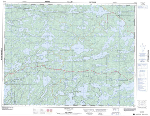
052F13 Feist Lake Canada topo map, 1:50,000 scale
052F13 Feist Lake NRCAN topographic map.
Includes UTM and GPS geographic coordinates (latitude and longitude). This 50k scale map is suitable for hiking, camping, and exploring, or you could frame it as a wall map.
Printed on-demand using high resolution, on heavy weight and acid free paper, or as an upgrade on a variety of synthetic materials.
Topos available on paper, Waterproof, Poly, or Tyvek. Usually shipping rolled, unless combined with other folded maps in one order.
- Product Number: NRCAN-052F13
- Parent Topo: TOPO-052F
- Map ID also known as: 052F13, 52F13
- Unfolded Size: Approximately 26" high by 36" wide
- Weight (paper map): ca. 55 grams
- Map Type: POD NRCAN Topographic Map
- Map Scale: 1:50,000
- Geographical region: Ontario, Canada
Neighboring Maps:
All neighboring Canadian topo maps are available for sale online at 1:50,000 scale.
Purchase the smaller scale map covering this area: Topo-052F
Spatial coverage:
Topo map sheet 052F13 Feist Lake covers the following places:
- Boulder Bay - Iowa Bay - Jackfish Bay - Long Bay - Noname Bay - Outlet Bay - Railway Bay - West Arm - Bridges - Desmond - Docker - MacNicol - Smellie - Tustin - Aaron Lake - Alexandra Lake - Anteater Lake - Augite Lake - Balmain Lake - Bass Lake - Bean Lake - Bee Lake - Beebee Lake - Big Beaver Lake - Big Island Lake - Big Moose Lake - Bill's Lake - Black Lakes - Blue Lake - Bowden Lake - Brown Trout Lake - Brownie Lake - Bruin Lake - Canyon Lake - Carnilac Lake - Clare Lake - Cobble Lake - Corner Lake - Crabclaw Lake - Daniels Lake - Dicker Lake - Eagle Lake - Earngey Lake - Edison Lake - Edward Lake - Favel Lake - Feist Lake - Flegg Lake - Foot Lake - Forest Lake - Game Lake - Geejay Lake - George Lake - Gooseneck Lake - Gordon Lake - Hagen Lake - Harrison Lake - Hawk Lake - Hornell Lake - Horseshoe Lake - Indian Lake - Island Lake - Kimber Lake - Kushog Lake - Lacourse Lake - Lift Lake - Lilium Lake - Linklater Lake - Little Gordon Lake - Little Joe Lake - Little Moose Lake - Lower Stewart Lake - Manomin Lake - Medicine Lake - Mirror Lake - Monkeywrench Lake - Mud Lake - Needle Lake - Octopus Lake - One Mile Lake - Otter Lake - Pearl Lake - Peterson Lake - Richard Lake - Robbie Burns Lake - S Lake - Shrub Lake - Silvery Lake - Skull Lake - Stewart Lake - Strawberry Lake - T Lake - Tilly Lake - Torrance Lake - Triangle Lake - Trout Lake - Upper Stewart Lake - Viaduct Lake - Violet Lake - Walleye Lake - Whitney Lake - Willard Lake - Windermere Lake - Winnange Lake - Winnange Lake Provincial Park - Berry River - Canyon River - Clare Creek - Crabclaw Creek - Daniels Creek - Dicker Creek - Flegg Creek - Gilbert Creek - Hagen Creek - Moose Creek - Shrub Creek - The Gilbert Stretch - Canyon - Edison - Favel - Hawk Lake - McIntosh - Pine - Willard Lake


