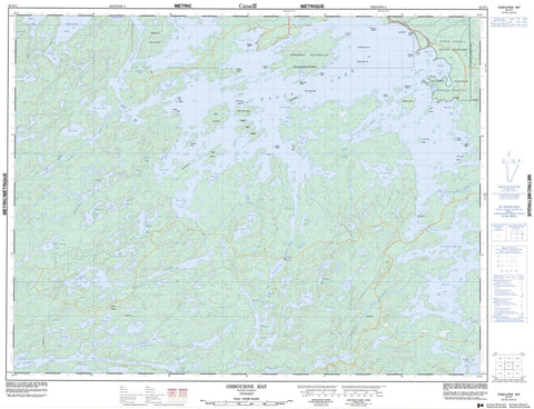
052F11 Osbourne Bay Canada topo map, 1:50,000 scale
052F11 Osbourne Bay NRCAN topographic map.
Includes UTM and GPS geographic coordinates (latitude and longitude). This 50k scale map is suitable for hiking, camping, and exploring, or you could frame it as a wall map.
Printed on-demand using high resolution, on heavy weight and acid free paper, or as an upgrade on a variety of synthetic materials.
Topos available on paper, Waterproof, Poly, or Tyvek. Usually shipping rolled, unless combined with other folded maps in one order.
- Product Number: NRCAN-052F11
- Parent Topo: TOPO-052F
- Map ID also known as: 052F11, 52F11
- Unfolded Size: Approximately 26" high by 36" wide
- Weight (paper map): ca. 55 grams
- Map Type: POD NRCAN Topographic Map
- Map Scale: 1:50,000
- Geographical region: Ontario, Canada
Neighboring Maps:
All neighboring Canadian topo maps are available for sale online at 1:50,000 scale.
Purchase the smaller scale map covering this area: Topo-052F
Spatial coverage:
Topo map sheet 052F11 Osbourne Bay covers the following places:
- Blind Bay - Bottle Bay - Boulder Bay - Buchan Bay - Camp 6 Bay - Canal Bay - Eldorado Bay - Fornieri Bay - Froghead Bay - Kennedy's Bay - Little Muskeg Bay - Littleneck Bay - McKenzie Bay - Meridian Bay - Mukluk Bay - Muskeg Bay - Nash's Bay - Niven Bay - Osbourne Bay - Outlet Bay - Portage Bay - Reserve Bay - Rice Bay - Smith's Bay - Spring Bay - Stanton Bay - Temple Bay - Bear Point - Birch Point - Detour Point - Farabout Peninsula - Hilder's Point - Midway Point - Partridge Point - Red Pine Point - Rendezvous Point - Windigo Point - Back Channel - Bear Narrows - Hole-in-the-Wall - Meridian Falls - Temple - Eagle Lake 27 - Eagle Lake Indian Reserve 27 - Réserve indienne Eagle Lake 27 - Beach Island - Birch Island - Boat Island - Burnt Island - East Long Island - East Three Sisters - Fish Camp Island - Float Island - Garden Island - Green Island - Lone Pine Island - Midway Island - Net Island - North Twin Island - Owl Island - Perkins Island - Poplar Island - Prendible Island - South Twin Island - Staton Island - Swanson Islands - Viking Island - West Long Island - West Three Sisters - Windigo Island - Alford Lake - Atikwa Lake - Bean Lake - Beaverhouse Lake - Big Goose Lake - Brown Trout Lake - Castor Lake - Chancellor Lake - Clearwater Lake - Darling Lake - Delano Lake - Eagle Lake - Easter Chicken Lake - Emmanuel Lake - Green Lake - Hartwick Lake - Higbee Lake - History Lake - Johnline Lake - Langford Lake - Line Lake - Little Goose Lake - Lost Lake - McGregor Lake - McKinstry Lake - Morah Lake - Mulcahy Lake - Oldcamp Lake - Passover Lake - Pelham Lake - Pikwans Lake - Prendible Lake - Robbins Lake - Scarp Lake - Secretary Lake - Shako Lake - Slaughterhouse Lake - Straight Lake - Trout Lake - Vee Lake - Walleye Lake - Machin - Eagle Lake Islands Conservation Reserve - Atikwa River - Barren Brook - Clearwater Creek - Darling Creek - Eagle River - Eldorado Creek - Meander Brook - Meander Creek - Meridian Creek - Nabish Creek - Piskegomang Brook - Rice River - Shako Creek - Ritchie Portage - Barber Pole - Coleman's Reef - Deadman's Reef - Skye's Reef - Viking Reef - Walleye Rock One - Walleye Rock Two - Eagle River - Migisi Sahgaigan


