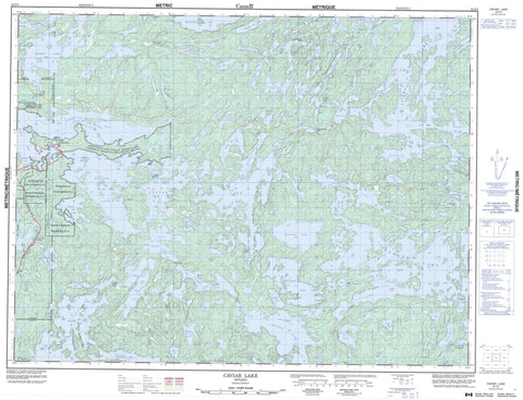
052F05 Caviar Lake Canada topo map, 1:50,000 scale
052F05 Caviar Lake NRCAN topographic map.
Includes UTM and GPS geographic coordinates (latitude and longitude). This 50k scale map is suitable for hiking, camping, and exploring, or you could frame it as a wall map.
Printed on-demand using high resolution, on heavy weight and acid free paper, or as an upgrade on a variety of synthetic materials.
Topos available on paper, Waterproof, Poly, or Tyvek. Usually shipping rolled, unless combined with other folded maps in one order.
- Product Number: NRCAN-052F05
- Parent Topo: TOPO-052F
- Map ID also known as: 052F05, 52F5, 52F05
- Unfolded Size: Approximately 26" high by 36" wide
- Weight (paper map): ca. 55 grams
- Map Type: POD NRCAN Topographic Map
- Map Scale: 1:50,000
- Geographical region: Ontario, Canada
Neighboring Maps:
All neighboring Canadian topo maps are available for sale online at 1:50,000 scale.
Purchase the smaller scale map covering this area: Topo-052F
Spatial coverage:
Topo map sheet 052F05 Caviar Lake covers the following places:
- Bog Bay - Brooks Bay - Emm Bay - Foreleg Bay - Grapnel Bay - Head Bay - Horn Bay - Lobstick Bay - Overflow Bay - Peninsula Bay - Regina Bay - Sammons Bay - Scott Bay - Snake Bay - Sullivan Bay - William Bay - Young Bay - Ells Peninsula - Devonshire - Phillips - Tweedsmuir - Willingdon - Réserve indienne Whitefish Bay 32A - Réserve indienne Whitefish Bay 33A - Réserve indienne Whitefish Bay 34A - Whitefish Bay 32A - Whitefish Bay 33A - Whitefish Bay 34A - Whitefish Bay Indian Reserve 32A - Whitefish Bay Indian Reserve 33A - Whitefish Bay Indian Reserve 34A - Martin Island - McKay Island - Shoulder Island - Allan Lake - Atikwa Lake - Atom Lake - Baby Shingwak Lake - Bag Lake - Beggs Lake - Berry Lake - Betula Lake - Cameron Lake - Caviar Lake - Cedartree Lake - Corbett Lake - Denmark Lake - Derry Lake - Dirtywater Lake - Dogpaw Lake - Dryberry Lake - Eliza Lake - Empire Lake - Flint Lake - Flora Lake - Goldilocks Lake - Granitic Lake - Harding Lake - Hope Lake - Isinglass Lake - Jessie Lake - Kakagi Lake - Kathleen Lake - Kenu Lake - Kishquabik Lake - Knutson Lake - Lac des Bois - Lake of the Woods - Le Gros Lake - Little Mekenak Lake - Mekenak Lake - Mongus Lake - Muscovite Lake - Mushkasu Lake - Newman Lake - Nolan Lake - Otakus Lake - Otterskin Lake - Overflow Lake - Ponyshoe Lake - Populus Lake - Rainmaker Lake - Rowan Lake - Rupert Lake - Sanford Lake - Shaw Lake - Shingwak Lake - Sickle Lake - Stephen Lake - Suttonly Lake - Tillie Lake - Wampum Lake - Wapus Lake - Warclub Lake - Waterfall Lake - Weisner Lake - Whirlpool Lake - Whitefish Lake - Wicks Lake - McGeorge & Willingdon - Sioux Narrows - Sioux Narrows Nestor Falls - Sioux Narrows-Nestor Falls - Dogpaw Rapids - Foam Rapids - Atikwa River - Berry Creek - Berry River - Brooks Creek - Cameron Creek - Cedartree River - Dirtywater Creek - Hope Creek - Mekenak Creek - Wapus River - Pawitik - Whitefish Bay


