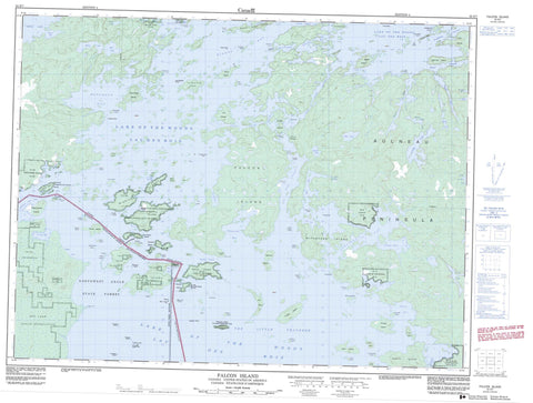
052E07 Falcon Island Canada topo map, 1:50,000 scale
052E07 Falcon Island NRCAN topographic map.
Includes UTM and GPS geographic coordinates (latitude and longitude). This 50k scale map is suitable for hiking, camping, and exploring, or you could frame it as a wall map.
Printed on-demand using high resolution, on heavy weight and acid free paper, or as an upgrade on a variety of synthetic materials.
Topos available on paper, Waterproof, Poly, or Tyvek. Usually shipping rolled, unless combined with other folded maps in one order.
- Product Number: NRCAN-052E07
- Parent Topo: TOPO-052E
- Map ID also known as: 052E07, 52E7, 52E07
- Unfolded Size: Approximately 26" high by 36" wide
- Weight (paper map): ca. 55 grams
- Map Type: POD NRCAN Topographic Map
- Map Scale: 1:50,000
- Geographical region: Ontario, Canada
Neighboring Maps:
All neighboring Canadian topo maps are available for sale online at 1:50,000 scale.
Purchase the smaller scale map covering this area: Topo-052E
Spatial coverage:
Topo map sheet 052E07 Falcon Island covers the following places:
- Astron Bay - Beaver Inlet - Bishop Bay - Boggy Bay - Deepwater Bay - Grassy Bay - Gull Bay - Little Traverse Bay - Loon Bay - Monument Bay - Northwest Angle Inlet - Outer Bay - Poachers Bay - Portage Bay - Redwater Bay - Rice Bay - Sabaskosing Bay - Sandy Bay - Spruce Portage Bay - The Little Traverse - Turtle Bay - Aulneau Peninsula - Bishop Point - Bunting's Point - Mica Point - Picture Rock Point - Sand Point - School House Point - Separation Point - Starting Point - Toadstool Point - Deadbroke Channel - Devils Elbow - Devil's Elbow - French Portage Narrows - Johnston Passage - Naongashing Channel - Sturgeon Channel - Sunset Channel - The Tug Channel - Tranquil Channel - Treaty Narrows - Whaler Channel - Agency 30 - Agency Indian Reserve 30 - Lake of the Woods 31C - Lake of the Woods 31G - Lake of the Woods 34 - Lake of the Woods 37 - Lake of the Woods 37B - Lake of the Woods Indian Reserve 31B - Lake of the Woods Indian Reserve 31C - Lake of the Woods Indian Reserve 31G - Lake of the Woods Indian Reserve 34 - Lake of the Woods Indian Reserve 37 - Lake of the Woods Indian Reserve 37B - Naongashing Indian Reserve 31A - Naongashing Indian Reserve 35A - Northwest Angle Indian Reserve 33B - Réserve indienne Agency 30 - Réserve indienne Lake of the Woods 31B - Réserve indienne Lake of the Woods 31C - Réserve indienne Lake of the Woods 31G - Réserve indienne Lake of the Woods 34 - Réserve indienne Lake of the Woods 37 - Réserve indienne Lake of the Woods 37B - Réserve indienne Naongashing 31A - Réserve indienne Naongashing 35A - Réserve indienne Northwest Angle 33B - Arrow Head Island - Bay Island - Betty Island - Birch Island - Bishop Point Island - Blaze Island - Bluff Island - Boucha Island - Bukete Island - Burnt Island - Burnt Rock Island - Calendar Island - Centre Island - Cliff Island - Clipper Island - Cochrane Island - Coste Island - Cyclone Island - Dagger Island - Deadbroke Island - Dog Island - Drift Island - Eagle Island - East Long Island - Egg Island - Egg Island - Enchanted Island - Falcon Island - Firebag Island - Fish Island - Folster Island - Gardner Island - High Island - Horse Island - Ike Island - Jessie Island - Kennedy Island - La Vérendrye Island - Lily Island - Little Eagle Island - Little Island - Little Smokey Island - Long Island - Low Island - Lynx Island - Massacre Island - McPherson Island - Mist Island - North Island - Onion Island - Passage Island - Pine Island - Poplar Island - Powder Island - Red Fox Island - Redrock Island - Rock Island - Rough Island - Royal Island - Sandy Bar Island - Skeet Island - Skiff Island - Spruce Island - Squaw Island - Thomas Island - Toadstool Island - Tranquil Island - Twin Island - Twin Islands - Willow Island - Windfall Island - Windigo Islands - Arrow Lake - Buck Lake - Deacon Lake - Don Lake - Dumbbell Lake - Dumbell Lake - Inland Lake - Lac des Bois - Lake of the Bays - Lake of the Woods - Mason Lake - Mason Lake - Maud Lake - O'Dell Lake - Pin Lake - Reid Lake - Reid Lake - Shoal Lake - Tex Lake - Westly Lake - Lake of the Woods - McCrosson and Tovell - Morson - Massacre Island Wilderness Area - Don Creek - O'Dell Creek - Flag Island Reef - Grandy Reef - Gull Reef - Gull Rock - Jean-Baptiste Rocks - Monkey Rocks Reef - Paquin Reef - Pinnacle Rock - Powassin Rock - Voyageur Rocks - French Portage - Naongashing


