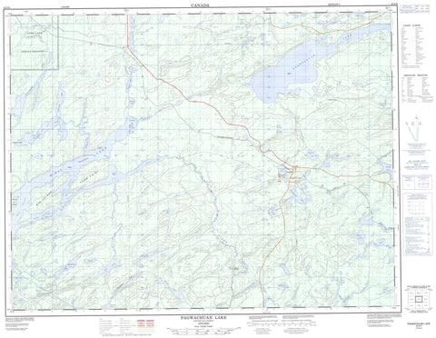
042E09 Pagwachuan Lake Canada topo map, 1:50,000 scale
042E09 Pagwachuan Lake NRCAN topographic map.
Includes UTM and GPS geographic coordinates (latitude and longitude). This 50k scale map is suitable for hiking, camping, and exploring, or you could frame it as a wall map.
Printed on-demand using high resolution, on heavy weight and acid free paper, or as an upgrade on a variety of synthetic materials.
Topos available on paper, Waterproof, Poly, or Tyvek. Usually shipping rolled, unless combined with other folded maps in one order.
- Product Number: NRCAN-042E09
- Parent Topo: TOPO-042E
- Map ID also known as: 042E09, 42E9, 42E09
- Unfolded Size: Approximately 26" high by 36" wide
- Weight (paper map): ca. 55 grams
- Map Type: POD NRCAN Topographic Map
- Map Scale: 1:50,000
- Geographical region: Ontario, Canada
Neighboring Maps:
All neighboring Canadian topo maps are available for sale online at 1:50,000 scale.
Purchase the smaller scale map covering this area: Topo-042E
Spatial coverage:
Topo map sheet 042E09 Pagwachuan Lake covers the following places:
- Boot Bay - Northeast Bay - Outlet Bay - Rankin Bay - Reedy Bay - Yankee Bay - Burnt Hill Point - Camping Point - Long Point - Poplar Point - Shanty Point - Morrin Channel - North Channel - South Channel - West Channel - Purgatory Chute - Ginoogaming First Nation Indian Reserve 77 - Long Lake Indian Reserve 77 - Réserve indienne Ginoogaming First Nation 77 - Réserve indienne Long Lake 77 - Big Island - Arms Lake - Bambino Lake - Bluejay Lake - Broadsword Lake - Caramat Lake - Cass Lake - Charon Lake - Decision Lake - Durn Lake - Eino Lake - Fairbairn Lake - Fairbairn Lake - Gabbro Lake - Gap Lake - Griffen Lake - Hagarty Lake - Heinrich Lake - Hoiles Lake - Hollowrock Lake - Kaboosa Lake - Koandowango Lake - Laponen Lake - Little Charon Lake - Little Hagarty Lake - Little McKay Lake - Loponen Lake - Lunam Lake - Lunom Lake - MacPherson Lake - Mamamia Lake - McKay Lake - Meg Lake - Moran Lake - Mustela Lake - Pagwachuan Lake - Pendant Lake - Picarson Lake - Pout Lake - Robb Lake - Rockyshore Lake - Sadie Lake - Sandlink Lakes - Seagram Lake - Snoopy Lake - Squash Lake - Star Lake - Upper Laponen Lake - Upper Loponen Lake - Willie Lake - Beardmore - Nakina - Bigrock Rapids - Arms Creek - Bambino Creek - Bluejay Creek - Caramat Creek - Charon Creek - Dianthus Creek - Divide Creek - Gabbro Creek - Griffen Creek - Hagarty Creek - Hagarty River - Hoiles Creek - Kaboosa Creek - Mustela Creek - Norse Creek - Pagwachuan River - Pendant Creek - Phipps Creek - Pic River - Picarson Creek - Pout River - Rockyshore Creek - Sandlink Creek - Charon Pass - Summit Portage - Greenstone - Arms - Caramat - Pagwachuan - Seagram


