
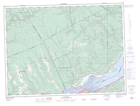
022B02 Oak Bay Canada topo map, 1:50,000 scale
022B02 Oak Bay NRCAN topographic map.
Includes UTM and GPS geographic coordinates (latitude and longitude). This 50k scale map is suitable for hiking, camping, and exploring, or you could frame it as a wall map.
Printed on-demand using high resolution, on heavy weight and acid free paper, or as an upgrade on a variety of synthetic materials.
Topos available on paper, Waterproof, Poly, or Tyvek. Usually shipping rolled, unless combined with other folded maps in one order.
- Product Number: NRCAN-022B02
- Parent Topo: TOPO-022B
- Map ID also known as: 022B02, 22B2, 22B02
- Unfolded Size: Approximately 26" high by 36" wide
- Weight (paper map): ca. 55 grams
- Map Type: POD NRCAN Topographic Map
- Map Scale: 1:50,000
- Geographical region: New Brunswick, Canada
Neighboring Maps:
All neighboring Canadian topo maps are available for sale online at 1:50,000 scale.
Purchase the smaller scale map covering this area: Topo-022B
Spatial coverage:
Topo map sheet 022B02 Oak Bay covers the following places:
- Anse Busteed - Baie au Chêne - Baie d'Escuminac - Pointe à Bourdeau - Pointe à la Batterie - Pointe à la Croix - Pointe à la Garde - Pointe au Chêne - Pointe aux Bouleaux - Pointe de la Mission - Pointe Indian - Pratt Point - Campbellton - Chutes à Normand - Assemetquagan - Avignon - Dalhousie - Dugal - Fauvel - Les Stigmates-de-Saint-François - Mann - Matapédia - Notre-Dame-de-la-Garde - Nouvelle - Restigouche - Ristigouche - Saint-André - Sainte-Hélène - Vallée - Listuguj Indian Reserve 1 - Réserve indienne Listuguj 1 - Réserve indienne Restigouche 1 - Restigouche Indian Reserve 1 - Long Island - Étang des Paradis - Hicks Lake - La Petite Prée - Lac à Nichol - Lac à Vallières - Lac des Bleuets - Lac des Capucins - Lac du Dix Milles - Lac Dubé - Lac Gapelanewey - Lac Glenn - Lac Indian - Lac Logotaganewey - Lac Maillard - Lacs à Blondon - Lacs Cassidy - Robertson Lake - Halte De La Giraudais - Callaghans Hill - Mont des Bouleaux Blancs - Mont Escuminac - Avignon - Bonaventure - Battle of the Restigouche National Historic Site of Canada - Lieu historique national du Canada de la Bataille-de-la-Ristigouche - Réserve écologique de Ristigouche - Zec Casault - Zec de la Rivière-Nouvelle - New Brunswick - Nouveau-Brunswick - Quebec - Québec - Coulée de la Source Salée - Hamilton Brook - La Petite Rivière - LeBlanc Brook - McLeods Brook - McLeods Brook - Old Mill Brook - Petit ruisseau Butler - Petite rivière du Loup - Petite Rivière Est - Petite Rivière Nord - Petite Rivière Ouest - Porcupine Brook - Restigouche River - Rivière Assemetquagan - Rivière du Loup - Rivière du Loup - Rivière Escuminac - Rivière Escuminac Nord - Rivière Kempt - Rivière Kempt Est - Rivière Kempt Nord - Rivière KemptOuest - Rivière Matapédia - Rivière Nouvelle - Rivière Restigouche - Rivière Ristigouche - Rivière Ristigouche - Ruisseau à Émile-Pitre - Ruisseau à Émile-Pitre - Ruisseau à l'Officier - Ruisseau à Rioux - Ruisseau Albert-Gendron - Ruisseau Alder d'en Bas - Ruisseau Alder d'en Haut - Ruisseau Basket - Ruisseau Big - Ruisseau Boulé - Ruisseau Burnt Land - Ruisseau Busteed - Ruisseau Butler - Ruisseau Clark - Ruisseau Clark Est - Ruisseau Couturier - Ruisseau Daudin - Ruisseau Dawson - Ruisseau Delaney - Ruisseau des Trente-Cinq Milles - Ruisseau Devils - Ruisseau du Camp 24 - Ruisseau du Castor - Ruisseau du Moulin - Ruisseau Dubé - Ruisseau Falls - Ruisseau Flatland - Ruisseau Fraser - Ruisseau Gilmour - Ruisseau Glenn - Ruisseau Harper - Ruisseau Harris - Ruisseau Harrison - Ruisseau Harvey - Ruisseau Jolicoeur - Ruisseau Kaine - Ruisseau La Garde - Ruisseau Lagacé - Ruisseau Landry - Ruisseau Lyons - Ruisseau Mann - Ruisseau McDonald - Ruisseau Moffet - Ruisseau Mongo - Ruisseau Monier - Ruisseau Normand - Ruisseau Purvis - Ruisseau Rocailleux - Ruisseau Rocky - Ruisseau Saint-Étienne - Ruisseau Savoy - Ruisseau Stewart - Ruisseau Ten Mile - Ruisseau Tilt - Ruisseau Vallée - Thompson Brook - Walker Brook - Fosse à la Truite - Fosse Gagnon - Fosse Reford - Fosse Sellars - Côte à Dancause - Côte des Crânes - Pont Dorval - La Petite Pointe - Broadlands - Cross Point - Cross Point Station - Dalhousie Junction - Dundee - Dundee - Escuminac Glen - Escuminac-Nord - La Fourche-à-Cellard - La Giraudais - Lagacé - L'Alverne - L'Alverne - Listuguj - Mann - Maple Green - McKinnons Hill - McLeod - McLeod Siding - McLeods - Oak Bay - Pointe-à-la-Croix - Pointe-à-la-Garde - Pointe-à-la-Garde - Restigouche - Richardsville - Saint-André-de-Restigouche - Saint-André-de-Restigouche - Saint-Conrad - Saint-Étienne-de-Restigouche - Saint-Étienne-de-Ristigouche - Saint-Laurent - Saint-Victor-de-Bonaventure - Sellarsville - Sillarsville - Upper Dundee - Coulée à Pico - Coulée à Polydore-Bernier - Coulée à Wallace - Coulée Camel - Coulée Cassidy - Coulée chez Edgar-Landry - Coulée chez Jos-Landry - Coulée chez Pierre - Coulée de la Mine à Bernard - Coulée des Charest - Coulée Dickson - Coulée du Camp Pointu - Coulée Ferguson - Coulée Hells - Coulée Nichol - Coulée Patton - Coulée Quinn - Marais de la Baie au Chêne - Escuminac - Mann - Matapédia - Nouvelle - Pointe-à-la-Croix - Ristigouche - Ristigouche-Partie-Sud-Est - Saint-André-de-Restigouche - Saint-Fidèle-de-Ristigouche - Saint-Jean-l'Évangéliste - Saint-Laurent-de-Matapédia


