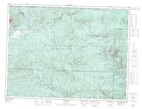
022A14 Lac York Canada topo map, 1:50,000 scale
022A14 Lac York NRCAN topographic map.
Includes UTM and GPS geographic coordinates (latitude and longitude). This 50k scale map is suitable for hiking, camping, and exploring, or you could frame it as a wall map.
Printed on-demand using high resolution, on heavy weight and acid free paper, or as an upgrade on a variety of synthetic materials.
Topos available on paper, Waterproof, Poly, or Tyvek. Usually shipping rolled, unless combined with other folded maps in one order.
- Product Number: NRCAN-022A14
- Parent Topo: TOPO-022A
- Map ID also known as: 022A14, 22A14
- Unfolded Size: Approximately 26" high by 36" wide
- Weight (paper map): ca. 55 grams
- Map Type: POD NRCAN Topographic Map
- Map Scale: 1:50,000
- Geographical region: Quebec, Canada
Neighboring Maps:
All neighboring Canadian topo maps are available for sale online at 1:50,000 scale.
Purchase the smaller scale map covering this area: Topo-022A
Spatial coverage:
Topo map sheet 022A14 Lac York covers the following places:
- Camping du Lac-York - Murdochville - Chute de l'Écluse - Champou - Fletcher - Gaspésie - Gastonguay - Holland - Laforce - Larocque - Lefrançois - Saint-Paul - Sirois - Deuxième lac Holland - Deuxième lac York - Lac à Legros - Lac à l'Orignal - Lac à l'Ours - Lac Audet - Lac aux Oies - Lac Blanc - Lac Bourget - Lac Briand - Lac Briggs - Lac Caché - Lac Creux - Lac de la Cache - Lac de la Loutre - Lac de l'Aéroport - Lac de l'Écluse - Lac des Monts - Lac Dubé - Lac Édouard - Lac Framboise - Lac Goose - Lac Hamel - Lac Keg Creek - Lac Noir - Lac Oatcake - Lac Outardes - Lac Rond - Lac Sasseville - Lac Sirois - Lac Verreault - Lac York - Lacs Caribou - Lacs Holland - Lacs Johnson - Lacs Longs - Lacs Tom - Petit lac Sirois - Petit lac York - Premier lac Holland - Collines du Basque - La Tailing Dam - Mont Bell - Mont I.-W.-Jones - Mont King - Mont Miller - Mont Porcupine - Mont Rothery - Mont York - Monts La Bolduc - Collines-du-Basque - Zec de la Rivière-York - Galeries Miller - Branche de la Madeleine - Branche Sud de la Rivière York - Décharge de la Loutre - Rivière à l'Eau Claire - Rivière Dartmouth - Rivière North Branch - Rivière Saint-Jean - Rivière Saint-Jean Branche Sud - Rivière Saint-Jean Ouest - Rivière York - Ruisseau au Castor - Ruisseau Bear - Ruisseau Béchervais - Ruisseau Bercharvais - Ruisseau Bill - Ruisseau Copper - Ruisseau Copper - Ruisseau du Basque - Ruisseau Édouard - Ruisseau Éphraim - Ruisseau Fall - Ruisseau Hamel - Ruisseau Holland - Ruisseau Johnson - Ruisseau Keg - Ruisseau Marten - Ruisseau Miller - Ruisseau NoName - Ruisseau Oat Keg - Ruisseau Oatcake - Ruisseau Offset - Ruisseau Patch - Ruisseau Patch Est - Ruisseau Pinehill - Ruisseau Porphyre - Ruisseau Random Hill - Ruisseau Rupert - Ruisseau Sinnett - Ruisseau Sirois - Ruisseau Sluice - Ruisseau Stanley - Ruisseau Tom - Ruisseau Whitehouse - Ruisseau Yvon - Fosse Big Beaver Dam - Fosse Big Eddy - Fosse de la Maison Blanche - Fosse du Pont - Fosse Garland - Fosse Keg - Fosse Patch - Fosse Pine Hill - Fosse Random - Fosse Spruin Rock - Fosse Stony Beaver Dam - Fosse Terry - La Maison Blanche - La Montagnard - La Truite - Le Pont - L'Écluse - L'Orignal - Keg Creek Cabin - Le Camp-Johnson - Mont-Miller - Murdochville - Whitehouse - Coulée des Soeurs


