
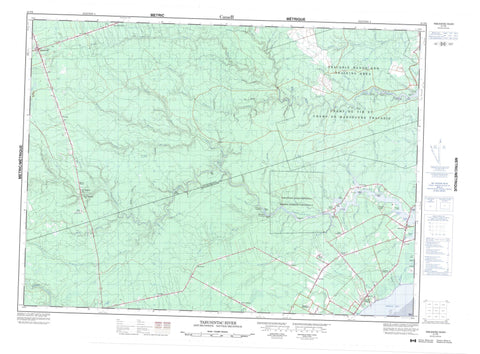
021P06 Tabusintac River Canada topo map, 1:50,000 scale
021P06 Tabusintac River NRCAN topographic map.
Includes UTM and GPS geographic coordinates (latitude and longitude). This 50k scale map is suitable for hiking, camping, and exploring, or you could frame it as a wall map.
Printed on-demand using high resolution, on heavy weight and acid free paper, or as an upgrade on a variety of synthetic materials.
Topos available on paper, Waterproof, Poly, or Tyvek. Usually shipping rolled, unless combined with other folded maps in one order.
- Product Number: NRCAN-021P06
- Parent Topo: TOPO-021P
- Map ID also known as: 021P06, 21P6, 21P06
- Unfolded Size: Approximately 26" high by 36" wide
- Weight (paper map): ca. 55 grams
- Map Type: POD NRCAN Topographic Map
- Map Scale: 1:50,000
- Geographical region: New Brunswick, Canada
Neighboring Maps:
All neighboring Canadian topo maps are available for sale online at 1:50,000 scale.
Purchase the smaller scale map covering this area: Topo-021P
Spatial coverage:
Topo map sheet 021P06 Tabusintac River covers the following places:
- French Cove - Hierlihys Cove - Murrays Cove - Neguac Bay - Neguac Beach - Barnabys Nose - Cap Blanc - Cap de Meule - Cap Nord - Frank Hyde Point - Indian Point - McKenzie Point - McRobie Point - Pointe à Charles Comeau - Pointe à Damase - Pointe à Ferdinand - Pointe à Honoré - Pointe du Vieux-Boom - Popple Point - Robichauds Point - Upper Long Stretch - Allardville - Alnwick - Gloucester - Newcastle - Northumberland - Saint-Isidore - Saumarez - Tabusintac 9 - Campbells Island - Old Dans Island - Redpine Island - Robertsons Island - Sheep Island - Neguac Lagoon - North Tabusintac Hill - South Tabusintac Hill - Rapide Blanc - Barnabys Nose Brook - Bartibog River - Beans Brook - Becks Brook - Big Bear Brook - Big Bear Brook - Big Brook - Big Brook - Big Eskedelloc River - Big Hole Brook - Big Hole Brook - Big Marsh Brook - Big Tracadie River - Brandy Brook - Camp Forbes Brook - Caribou Brook - Clearwater Brook - Coal Mine Brook - Codfish Brook - Cove Brook - Cowassaget Stream - Davidson Brook - Davidsons Brook - Deep Gulch Brook - Deep Pine Brook - Foriens Brook - Frank Hyde Brook - French Cove Brook - Gaspereau Brook - Godins Brook - Greystone Brook - Hay Landing Brook - High Landing Brook - Jam Brook - Johnson Brook - Leech River - Little Bear Brook - Little Eskedelloc - Little Eskedelloc River - Little North Brook - Little South Branch Big Tracadie River - Little South Branch River - Little South Tracadie River - Little Tracadie River - Lord and Foy Brook - Maliaget Brook - Maliget Brook - Malpec Brook - McKnights Brook - McLeods Brook - McLeod's Brook - McRobie Brook - Meadow Brook - Middle Brook - Moose Brook - North Branch Burnt Church River - North Brook - North Brook - Otter Brook - Pisiguit Brook - Portage Brook - Portage River - Red Landing Brook - Rivière des Caches - Rivière du Portage - Robinson Brook - Ruisseau à Allain - Ruisseau à Tom - Ruisseau Aimée - Ruisseau aux Trois-Ormes - Ruisseau de la Mollasse - Spring Brook - Stilson Brook - Straight Brook - Stymest Millstream - Stymiests Mill Brook - Tabusintac River - Tracadie River - Trout Brook - Weeks Brook - Wildcat Brook - Devils Elbow - Long Stretch - Long Stretch - Allainville - Allardville - Allardville East - Bear Landing - Breau Road - Cain Point - Cains Point - Christies Landing - Comeau Settlement - Covedell - Daulnay - Fairisle - Gaythorne - Grattan - Jeanne Mance - Jeanne-Mance - Lauvergot - Lavillette - Lower Neguac - Morrissy - Old Dans Landing - Price Settlement - Robichaud Settlement - Saint-Wilfred - Savoy - St. Wilfred - Stymiest Road - Tabusintac - Veniot - Blakes Gulch - Cronins Gulch - Dionne Gulch - Duillaume Gulch - Dunbar Gulch - Gormans Gulch - Gulch à Anastase - Gulch à Cyrille - Gulch à Geordie - Gulch à Isaïe - Loggies Gulch - Russells Gulch - Youngs Gulch - Anglin Plain - Big Marsh - Black Lands - Tracadie Camp


