
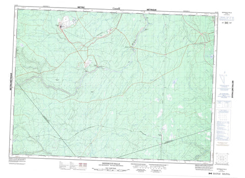
021P05 Nepisiguit Falls Canada topo map, 1:50,000 scale
021P05 Nepisiguit Falls NRCAN topographic map.
Includes UTM and GPS geographic coordinates (latitude and longitude). This 50k scale map is suitable for hiking, camping, and exploring, or you could frame it as a wall map.
Printed on-demand using high resolution, on heavy weight and acid free paper, or as an upgrade on a variety of synthetic materials.
Topos available on paper, Waterproof, Poly, or Tyvek. Usually shipping rolled, unless combined with other folded maps in one order.
- Product Number: NRCAN-021P05
- Parent Topo: TOPO-021P
- Map ID also known as: 021P05, 21P5, 21P05
- Unfolded Size: Approximately 26" high by 36" wide
- Weight (paper map): ca. 55 grams
- Map Type: POD NRCAN Topographic Map
- Map Scale: 1:50,000
- Geographical region: New Brunswick, Canada
Neighboring Maps:
All neighboring Canadian topo maps are available for sale online at 1:50,000 scale.
Purchase the smaller scale map covering this area: Topo-021P
Spatial coverage:
Topo map sheet 021P05 Nepisiguit Falls covers the following places:
- The Narrows - Nepisiguit Falls - Allardville - Bathurst - Gloucester - Newcastle - Northesk - Northumberland - Bear Island - Big Meadow Island - Dicks Island - Duck Island - Middle Island - Round Island - Bass River Lake - East Branch Lake - Island Lake - Lovalls Lake - North Branch Lake - Pabineau Lake - Russell Lake - Chain of Rocks Rapids - Middle Landing Rapids - Push and Be Damned Rapids - Aubrey Brook - Austin Brook - Bartibog River - Bass Brook - Bass River - Big Eskedelloc River - Campbell Brook - Coal Branch Brook - Cold Branch Brook - East Bass River - East Branch - East Branch Bass River - East Branch Portage River - East Gordon Meadow Brook - East Portage River - Flat Landing Brook - Fleming Brook - Flemming Brook - Flemming Brook - Gilmour Brook - Gordon Meadow Brook - Hatchery Brook - Kinnears Brook - Knight Brook - Knights Brook - Lake Brook - Lavignes Brook - Lawson Brook - Little Bass River - Little River - Little River - Little South Branch Pabineau River - Little South Branch Tomogonops River - Little South Pabineau River - Little South Tomogonops River - Maliaget Brook - Maliget Brook - McKay Brook - Middle Landing Brook - Muddy Lake Brook - Nepisiguit Brook - Nepisiguit River - Nine Mile Brook - Ninemile Brook - Nipisiguit River - North Bartibog River - North Branch - North Branch Bartibog River - North Branch Tabusintac River - North Branch Tomogonops River - North Ninemile Brook - North Tabusintac River - Number Two Brook - Pabineau River - Portage Brook - Portage River - Red Pine Brook - Reids Brook - Rocky Brook - Rocky Brook - Roughwater Brook - Sandburn Brook - South Branch Little River - South Branch Pabineau River - South Branch Tomogonops River - South Little River - South Pabineau River - South Tomogonops River - Straughan Brook - Sugary Brook - Tabusintac River - Taylor Brook - Tomogonops River - Tomogonops River - Tozer Brook - Upper South Little River - Bartibog Station - Bathurst Mines - Bruce - Brunswick Mines - Middle Landing - Red Pine - Russell - Pentland Gulch - Doctor Bells Meadow - Herman Goods Meadow


