
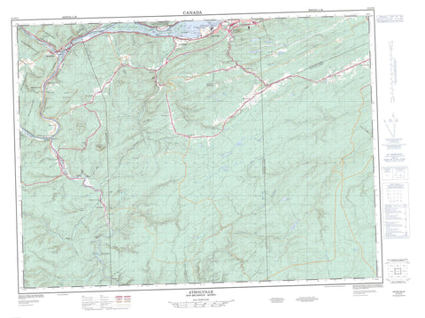
021O15 Atholville Canada topo map, 1:50,000 scale
021O15 Atholville NRCAN topographic map.
Includes UTM and GPS geographic coordinates (latitude and longitude). This 50k scale map is suitable for hiking, camping, and exploring, or you could frame it as a wall map.
Printed on-demand using high resolution, on heavy weight and acid free paper, or as an upgrade on a variety of synthetic materials.
Topos available on paper, Waterproof, Poly, or Tyvek. Usually shipping rolled, unless combined with other folded maps in one order.
- Product Number: NRCAN-021O15
- Parent Topo: TOPO-021O
- Map ID also known as: 021O15, 21O15
- Unfolded Size: Approximately 26" high by 36" wide
- Weight (paper map): ca. 55 grams
- Map Type: POD NRCAN Topographic Map
- Map Scale: 1:50,000
- Geographical region: New Brunswick, Canada
Neighboring Maps:
All neighboring Canadian topo maps are available for sale online at 1:50,000 scale.
Purchase the smaller scale map covering this area: Topo-021O
Spatial coverage:
Topo map sheet 021O15 Atholville covers the following places:
- Copeland Beach - Gracies Beach - Hulls Beach - Jerrys Beach - Larkins Beach - Marshalls Beach - Plum Beach - Ferguson Point - Old Church Point - Old Mission Point - Campbellton - Boland Brook Falls - Great Falls - Little Falls - Addington - Balmoral - Dalhousie - Matapédia - Restigouche - Ristigouche - Saint-Laurent - Adams Island - Apple Island - Apple Island - Bell Island - Bill Mann Islands - Boulton Island - Butters Islands - Clarke Island - Croswell Island - Delaney Island - Demeau Island - Dickson Island - Duffs Island - Duncan Island - Ferguson Island - Fraser Island - Gillis Island - Greens Island - Grog Island - Île Cheator - Île Haley - Jellot Island - La Petite Île - Long Island - Mann Island - Mann Islands - Marshalls Island - McBeath Island - McCormack Island - Mike Island - Mink Island - Moses Island - Murray Island - Murray Islands - Poker Island - Prichards Island - Pritchard Island - Sheep Island - Smith Island - Taylor Island - Two Mile Island - Upsalquitch Island - Arseneau Lake - Black Lake - Caldwell Lake - Crooked Lake - Doucet Lake - Duff Lake - Duffs Lake - Fourteen Mile Lake - Hall Shed Lake - Halls Shed Lake - Indian Lake - Juniper Lake - LaMontagne Lake - Lily Lake - Loch Lomond - Lost Pine Lake - McCabe Lake - Mud Lake - Parker Lake - Popelogan Lake - Prichard Lake - Sharps Lake - Smith Lake - South Lake - Twenty One Mile Lake - Mann Mountain - Seven Mile Ridge - Slate Mountain - Squaw Cap Mountain - Sugar Hill - Sugarloaf Mountain - Morrissey Rock Provincial Park - Sugarloaf Provincial Park - Rocky Rapids - Archibald Brook - Arsenault Brook - Babcock Brook - Baker Brook - Berry Brook - Black Brook - Boland Brook - Charlo River - Chesser Brook - Chessers Brook - Chouinard Brook - Christopher Brook - Cleveland Brook - Cold Brook - Cold Gulch - Copeland Brook - Coxs Brook - Croswell Brook - Dawson Brook - Duff Lake Brook - Duffs Lake Brook - East Branch Christopher Brook - East Christopher Brook - Eel River - Ferguson Creek - Firth Brook - Gimlet Brook - Gordon Creek - Goulette Brook - Grog Brook - Harris Brook - Harris Brook - Indian Brook - Lebel Brook - Lefurgey Brook - Lily Lake Brook - Little Berry Brook - Little Falls Brook - Little Popelogan Brook - Lower Indian Brook - McDougall Brook - McEwan Gulch - McLeod Brook - Meadow Brook - Middle Branch Eel River - Middle Eel River - Middle Eel River - Mill Brook - Monique Brook - Narrows Brook - North Branch Charlo River - North Branch Eel River - North Charlo River - North Eel River - North Two Brooks - Old Mill Brook - Pollock Brook - Popelogan Lake Branch River - Popelogan River - Rafting Ground Brook - Red Brook - Restigouche River - Rivière Matapédia - Rivière Restigouche - Rivière Ristigouche - Rivière Ristigouche - Robinson Brook - Rocky Brook - Rocky Gulch - Ruisseau Caldwell - Ruisseau de l'Indien - Ruisseau Delaney - Ruisseau England - Ruisseau Fraser - Ruisseau Gilmour - Ruisseau Haley - Ruisseau Harris - Ruisseau John - Ruisseau Lagacé - Ruisseau Moore - Ruisseau Moores - Ruisseau Ryan - South Branch Eel River - South Eel River - Stewart Brook - Tardie Brook - Thompson Brook - Upper Indian Brook - Upsalquitch River - Wadens Rock Brook - Walker Brook - Wharf Landing Brook - Wodens Rock Brook - Wyers Brook - Fergusons Turn - Fosse Alexander - Fosse Cheator - Fosse Delaney - Fosse des Îles - Fosse du Pont Mercier - Fosse du Ruisseau de l'Indien - Fosse du Ruisseau Gilmour - Fosse Duncan Hole - Fosse Haley - Fosse Lawlor - Fosse Lawlor's Rock - Fosse Pot Hole - Fosse Railroad d'en Bas - Fosse Ryan - Fosse Sheep - Fosse Ted's Rock - Fosse Tobique Home - Fosse Warren - La Traverse - Pont Matapédia - Pont Mercier - Morrissey Rock - Morrisy Rock - Blair Athol - Brassard - Broadlands - Camp Harmony - Christopher - Colebrooke Settlement - Dawsonville - Felix Gulch - Flatlands - Glen Levit - Glencoe - Glenlivet - Lac des Lys - Lac-des-Lys - Léonard-de-Matapédia - Macabee - Malauze - Maltais - Mann Mountain - Mann Mountain Settlement - Matapédia - Matapédia-Ouest - McKendrick - Napier - Red Bank Camp - Robinsonville - Runnymede - Saint-Arthur - Saint-Aubin - Saint-Laurent - Secteur Ristigouche - Squaw Cap - St. Albert - St. Arthur - St. Arthur West - St. Aubin - St-Arthur - St-Aubin - Upper Balmoral - Upsalquitch - Val d'Amour - Val Melanson - Val-d'Amour - Val-Melanson - Wyers Brook - Blind Gulch - Bogan Gulch - Bramham Gulch - Burnt Gulch - Caissie Gulch - Carrs Gulch - Clevelands Gulch - Coulée Dickson - Coulée McDavid - Doubloon Gulch - Eight Mile Gulch - Felix Gulch - Flahertys Gulch - Flaradies Gulch - Frying Pan Gulch - Greys Gulch - Harris Gulch - Keirstead Gulch - MacDougall Gulch - Manns Gulch - McEwan Gulch - McKenzie Gulch - Moores Gulch - Murray Gulch - Pelletier Gulch - Pine Gulch - Reids Gulch - Rocky Gulch - Rocky Rapids Gulch - Schoolhouse Gulch - Sewells Gulch - Smith Gulch - Squirrel Jump Gulch - Tardif Gulch - Two Mile Island Gulch - Wheeler Gulch - White Meadows - Atholville - Matapédia - Saint-Alexis-de-Matapédia - Saint-Laurent-de-Matapédia - Tide Head


