
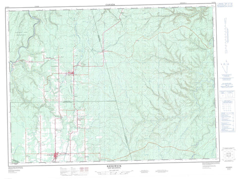
021O11 Kedgwick Canada topo map, 1:50,000 scale
021O11 Kedgwick NRCAN topographic map.
Includes UTM and GPS geographic coordinates (latitude and longitude). This 50k scale map is suitable for hiking, camping, and exploring, or you could frame it as a wall map.
Printed on-demand using high resolution, on heavy weight and acid free paper, or as an upgrade on a variety of synthetic materials.
Topos available on paper, Waterproof, Poly, or Tyvek. Usually shipping rolled, unless combined with other folded maps in one order.
- Product Number: NRCAN-021O11
- Parent Topo: TOPO-021O
- Map ID also known as: 021O11, 21O11
- Unfolded Size: Approximately 26" high by 36" wide
- Weight (paper map): ca. 55 grams
- Map Type: POD NRCAN Topographic Map
- Map Scale: 1:50,000
- Geographical region: New Brunswick, Canada
Neighboring Maps:
All neighboring Canadian topo maps are available for sale online at 1:50,000 scale.
Purchase the smaller scale map covering this area: Topo-021O
Spatial coverage:
Topo map sheet 021O11 Kedgwick covers the following places:
- Little Cross Point - Drummond - Eldon - Grimmer - Restigouche - Half Mile Island - Little Cross Islands - Little Cross Point Islands - Étangs Morin - Lac à Blanchette - Lac à Morin - Lac du Petit-Vingt-Deux - McKenzie Lake - Morin Pond - Poison Lake - Brodericks Hill - Bear Brook - Bernier Brook - Black Brook - Boland Brook - Burntland Brook - Chisholm Brook - Coulée à Siméon - Cross Point Brook - Dead Brook - Deadwater Brook - Five Finger Brook - Five Fingers Brook - Four Mile Brook - Fourmile Brook - Haffords Brook - Haffords Brook - Hailes Brook - Hashey Brook - Indian Brook - Kedgwick River - Little Five Finger Brook - Little Five Fingers Brook - Little Main Restigouche River - McLeod Brook - Northwest Upsalquitch River - Oxford Brook - Pat Brook - Range Brook - Restigouche River - Restigouche River - Ritchie Brook - Rivière Ristigouche - Robinson Brook - Ruisseau Donat-Albert - Ruisseau Rang-Cinq-et-Six - Ruisseau Sauvage - Soldiers Brook - Stillwater Brook - Thirty Mile Brook - Thirtymile Brook - Twelve Mile Brook - Twenty Eight Mile Brook - Twenty Five Mile Brook - Twenty Seven Mile Brook - Twenty-Eight Mile Brook - Twenty-Five Mile Brook - Twenty-Seven Mile Brook - White Brook - Whites Brook - Saint-Quentin - Drucour - Five Fingers - Grimmer Settlement - Guercheville - Hazen Settlement - Kedgwick Ouest - Kedgwick River - Kedgwick-Ouest - Lauzier - Leclerc - Limerick - Mann Siding - Nickel Mill - Oliver - Petite-Réserve - Petit-Ouest - Quatre-Milles - Rang Six Milles - Rang-Dix - Rang-Dix-Huit - Rang-Double-Nord - Rang-Double-Sud - Rang-Douze - Rang-Douze-Nord - Rang-Seize - Rang-Sept - Rang-Sept-et-Huit - Robinson - Robinson Tank - Saint-Martin-de-Restigouche - Sancta Anna - Six-Milles - St. Martin de Restigouche - Stewart Settlement - St-Martin-de-Restigouche - Thibault - Val Riopel - Val-Riopel - White Brook - Whites Brook - Downs Gulch - Gillis Gulch - Halls Gulch - Larry Gulch - Larrys Gulch - Lower Downs Gulch - McKenzie Gulch - Murray Gulch - Simpsons Gulch - Upper Downs Gulch - Kedgwick - St. Quentin - St-Quentin


