
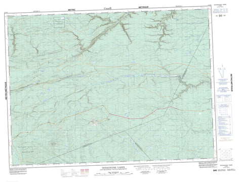
021O09 Tetagouche Lakes Canada topo map, 1:50,000 scale
021O09 Tetagouche Lakes NRCAN topographic map.
Includes UTM and GPS geographic coordinates (latitude and longitude). This 50k scale map is suitable for hiking, camping, and exploring, or you could frame it as a wall map.
Printed on-demand using high resolution, on heavy weight and acid free paper, or as an upgrade on a variety of synthetic materials.
Topos available on paper, Waterproof, Poly, or Tyvek. Usually shipping rolled, unless combined with other folded maps in one order.
- Product Number: NRCAN-021O09
- Parent Topo: TOPO-021O
- Map ID also known as: 021O09, 21O9, 21O09
- Unfolded Size: Approximately 26" high by 36" wide
- Weight (paper map): ca. 55 grams
- Map Type: POD NRCAN Topographic Map
- Map Scale: 1:50,000
- Geographical region: New Brunswick, Canada
Neighboring Maps:
All neighboring Canadian topo maps are available for sale online at 1:50,000 scale.
Purchase the smaller scale map covering this area: Topo-021O
Spatial coverage:
Topo map sheet 021O09 Tetagouche Lakes covers the following places:
- Rocky Turn Falls - Balmoral - Bathurst - Beresford - Colborne - Durham - Gloucester - Northumberland - Restigouche - Moose Meadows 4 - Beaver Lake - Black Lake - Blue Lake - Cedar Lake - Fournier Lake - Fulton Lake - Head Lake - Hogan Pond - Island Lake - Jacquet River Lakes - Juniper Lake - Lower Goose Pond - Lower Tetagouche Lake - Lucky Lake - McRae Lake - Meadow Lakes - Middle Tetagouche Lake - Millstream Lake - Murray Lake - Tongue Lake - Upper Goose Pond - Upper Tetagouche Lake - Black Top Mountain - Camel Back Mountain - Jacquet River Hill - McGregor Hill - Mount Jack - Naturalists Mountains - Rocky Turn Rapids - Arleau Brook - Armstrong Brook - Boudreau Brook - Campbell Brook - Campbell Brook - Caribou Brook - Caribou Brook - Cormier Brook - East Branch Forty Four Mile Brook - Eighteen Mile Brook - Eighteenmile Brook - Forty Four Mile Brook - Forty Mile Brook - Fortymile Brook - Four Mile Brook - Fournier Brook - Fraser Brook - Gambol Brook - Jacquet River - Johnson Brook - Johnson Brook - Levesque Brook - Little Southeast Upsalquitch River - Lower McNair Brook - Lower South Branch Jacquet River - Lower South Jacquet River - Lucky Lake Brook - McNair Brook - Meadow Brook - Melanson Brook - Middle Brook - Middle River - Millstream River - Murray Brook - Murray Lake Brook - Nine Mile Brook - Ninemile Brook - North Branch Meadow Brook - North Branch Middle River - North Branch Tetagouche River - North Meadow Brook - North Middle River - North Tetagouche River - Orvan Brook - Paynes Brook - Peters Brook - Rocky Brook - Rocky Brook - Shellalah Hill Brook - South Branch Forty Mile Brook - South Branch Middle River - South Branch Nigadoo River - South Branch Tetagouche River - South Fortymile Brook - South Jacquet River - South Middle River - South Nigadoo River - South Tetagouche River - Southeast Jacquet River - Southeast Upsalquitch River - Taylor Brook - Tetagouche River - Two Pitch Hill Brook - Upper McNair Brook - Upper South Branch Jacquet River - Upper South Jacquet River - West Branch Forty Four Mile Brook - West Branch Tetagouche River - West Tetagouche River - West Tetagouche River - White Birch Brook - Wild Cat Brook - Wildcat Brook - Woodside Brook - Harrys Bogan - Rocky Turn Pool - Big Moose - Caribou Depot - Keepover - The Sheds - Archibald Gulch - Carl Gulch - Cook Gulch - Cook Savoie Gulch - Culligan Gulch - McNair Gulch - Moosehorn Gulch - Paul Phillip Gulch - Personne Gulch - Peter Frank Gulch - Rocky Gulch - Rocky Turn Gorge - Salter Gulch - Snowslide Gulch - Tremblay Gulch - Rocky Brook Plains - Taylor Meadow


