
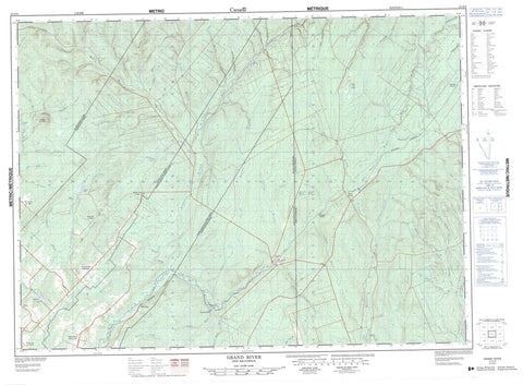
021O05 Grand River Canada topo map, 1:50,000 scale
021O05 Grand River NRCAN topographic map.
Includes UTM and GPS geographic coordinates (latitude and longitude). This 50k scale map is suitable for hiking, camping, and exploring, or you could frame it as a wall map.
Printed on-demand using high resolution, on heavy weight and acid free paper, or as an upgrade on a variety of synthetic materials.
Topos available on paper, Waterproof, Poly, or Tyvek. Usually shipping rolled, unless combined with other folded maps in one order.
- Product Number: NRCAN-021O05
- Parent Topo: TOPO-021O
- Map ID also known as: 021O05, 21O5, 21O05
- Unfolded Size: Approximately 26" high by 36" wide
- Weight (paper map): ca. 55 grams
- Map Type: POD NRCAN Topographic Map
- Map Scale: 1:50,000
- Geographical region: New Brunswick, Canada
Neighboring Maps:
All neighboring Canadian topo maps are available for sale online at 1:50,000 scale.
Purchase the smaller scale map covering this area: Topo-021O
Spatial coverage:
Topo map sheet 021O05 Grand River covers the following places:
- Drummond - Notre-Dame-de-Lourdes - Sainte-Anne - Saint-Léonard - Burgess Lake - Mud Lake - Quisibis Lake - Siegas Lake - Quisibis Mountain - Alex Brook - Beaver Brook - Big Fork Grand River (Grande fourche Grande Rivière) - Big Fork Quisibis River (Grande fourche rivière Quisibis) - Big Forks Brook - Big John Brook - Big Spring Brook - Bijeau Brook - Black Brook - Boston Brook - Brown Brook - Burgess Brook - Cedar Brook - Centre Brook - Claire Brook - Clark Brook - Deadwater Brook - Deadwater Grand River - Depot Brook - East Jardine Brook - Four Mile Brook - Fourche à Clark - Fourmile Brook - Goldstream Brook - Grand River (Grande Rivière) - Grande fourche Grande Rivière - Grande fourche rivière Quisibis - Grande Rivière - Grindstone Brook - Hammond Brook - Hunter Brook - Jardine Brook - Jardine Brook - Kelly Brook - Larry Brook - Left Hand Branch Grindstone Brook - Left Hand Grindstone Brook - Little Beaver Brook - Little Fork Quisibis River (Petite fourche rivière Quisibis) - Little John Brook - Little Main Restigouche River - Little River - Martial Brook - McIntosh Brook - Middle Branch Grindstone Brook - Middle Grindstone Brook - Mud Brook - Perkins Brook - Petite fourche rivière Quisibis - Poitras Brook - Range Brook - Restigouche River - Right Hand Branch Grindstone Brook - Right Hand Branch Jardine Brook - Right Hand Grindstone Brook - Rivière Siegas - Rob Brook - Rocky Brook - Ruisseau à Arsenault - Ruisseau Martial - Ruisseau Noir - Ruisseau Rang-Cinq-et-Six - Russell Brook - Salmon River - Sewell Brook - Siegas River - Taylor Brook - Tedley Brook - Thornton Brook - Violette Brook - Wagan Brook - Wagansis Brook - Wilson Brook - Yellow Brook - Big Forks Quisibis River - Little Forks Quisibis River - Black Brook - Dubé - Flemming - Flemming Siding - Fourche-à-Clark - Grand River - Hammond - Jardine Brook - Miller Line Cache - Montagne-des-Roy - Notre-Dame-de-Lourdes - Rang Deschenes - Rang-des-Deschêne - Siegas Lake Settlement - Sirois - Sirois - Upper Siegas - Veneer - Violette Brook - Grindstone Gulch - Ouellette Gulch - Skin Gulch - Therriault Gulch - Therrien Gulch


